
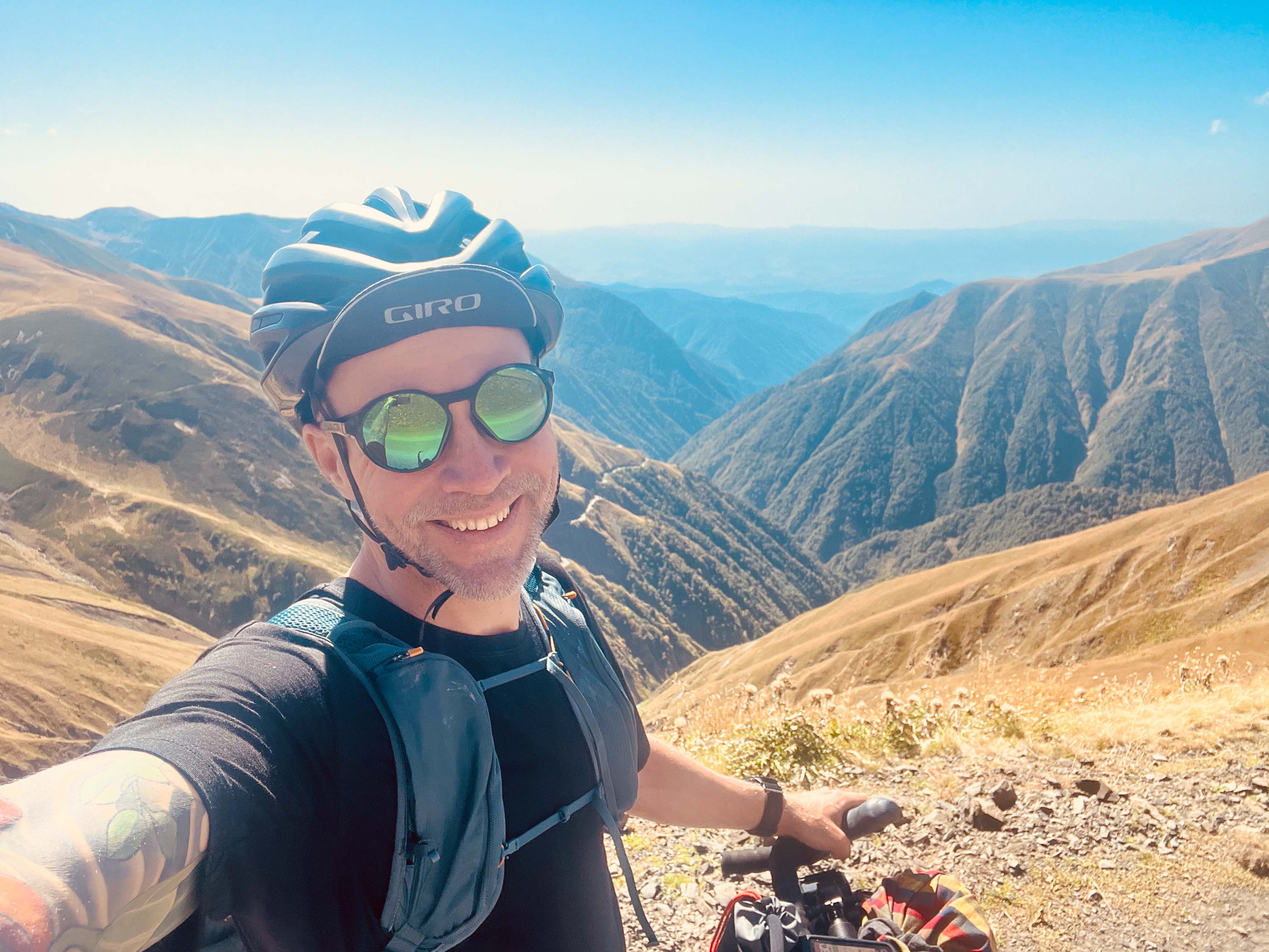
Tbilisi airport at 4:30 AM. Standing next to luggage belt with a bunch of sleepy passengers, hoping my bike made it through the transfer in Riga.
My yellow bike box is easy to spot from afar. Half-asleep, I start pushing it towards arrivals hall. Despite the early hour, there are already several taxi drivers offering their services. My pre-arranged pickup from the hotel is nowhere to be found.
After a while, the hall begins to empty out. Not sure what to do. I have the hotel address – but then again – someone should be here to pick me up. We messaged each other just yesterday.
Suddenly, my phone beeps with a text telling me to head out of the airport and turn left. This is quickly followed by another one telling the same thing guiding to turn right instead. Confused, I start pushing my bike box towards the exit.
Cool morning air is a welcome relief after long flight, and I take a moment to stretch my legs and get my bearings. It’s calm and quiet, not many people around. I decide to follow the latest guidance and start heading right. Sure enough, someone approaches me asking – “Teemu?”.
He turns out to be the son of the hotel owner, a friendly young man who quickly introduces himself and offers to help me with my bike box. I gratefully accept, and we load it into the back of his car before setting off into the quiet, dark streets of Tbilisi.
As we drive through the city, we chat about family and the recent politics of the region. It’s clear that he has a lot of pride in his country and its history. He’s really talkative, and I find myself getting more and more interested in what he has to say.
Before long, we arrive at the hotel and he leaves me in the dimly-lit restaurant with a cup of steaming coffee, and heads off to bed to continue his interrupted night sleep. In the light of my head torch, I open my bike box and start putting together the bike. I promised to be ready before 7AM when the room is needed for breakfast.
As the sun rises, the restaurant starts to fill up with other travellers. Discussion is a mix of Georgian and Russian. I don’t understand a word. Sitting there with another cup of coffee, watching the waitresses run back and forth carrying small plates from the kitchen, I feel a mix of excitement and nervousness.
I’m really excited to finally get going after weeks of packing, planning, waiting, and worrying. At the same time, there are the familiar doubts bugging in the background. Did I really think of all the equipment I need for the trip? How much food should I pack from the get go? How do I fare with the sheepdogs? Going to Chechen border zone – really?
Where will I sleep tonight?
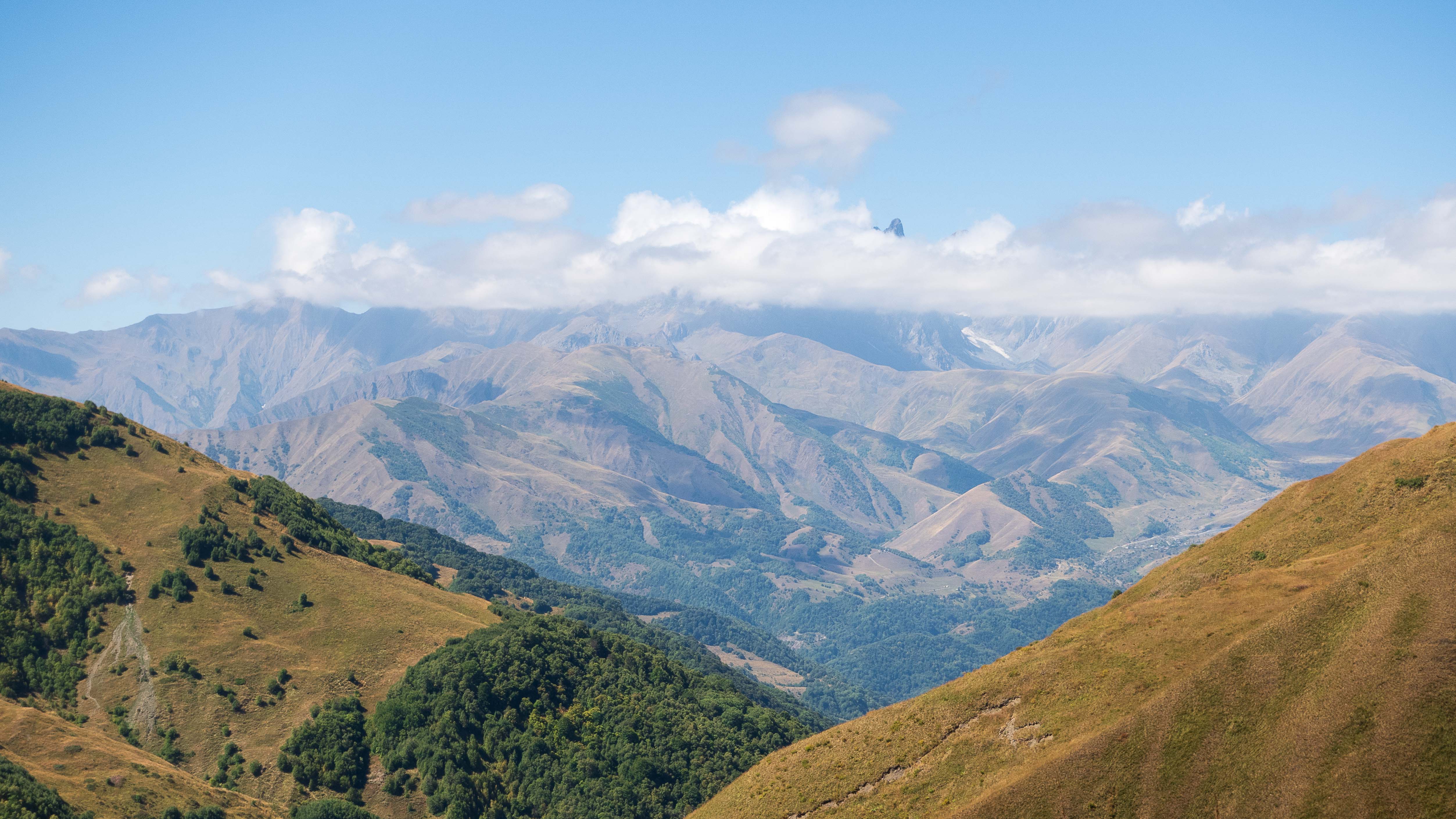
Out of Tbilisi
My rough plan was to follow Caucasus Crossing bikepacking trail north from Tbilisi, cross Atsunta Pass, cycle through the remote valley of Tusheti along Chechnya border, and come back down from the other end through Albano Pass.
Once done with the loop, I would somehow arrange myself a transport to the western side of the country, and from there, cycle back to Tbilisi through Lesser Caucasus mountains. It all looked somewhat doable on my plan in Komoot.

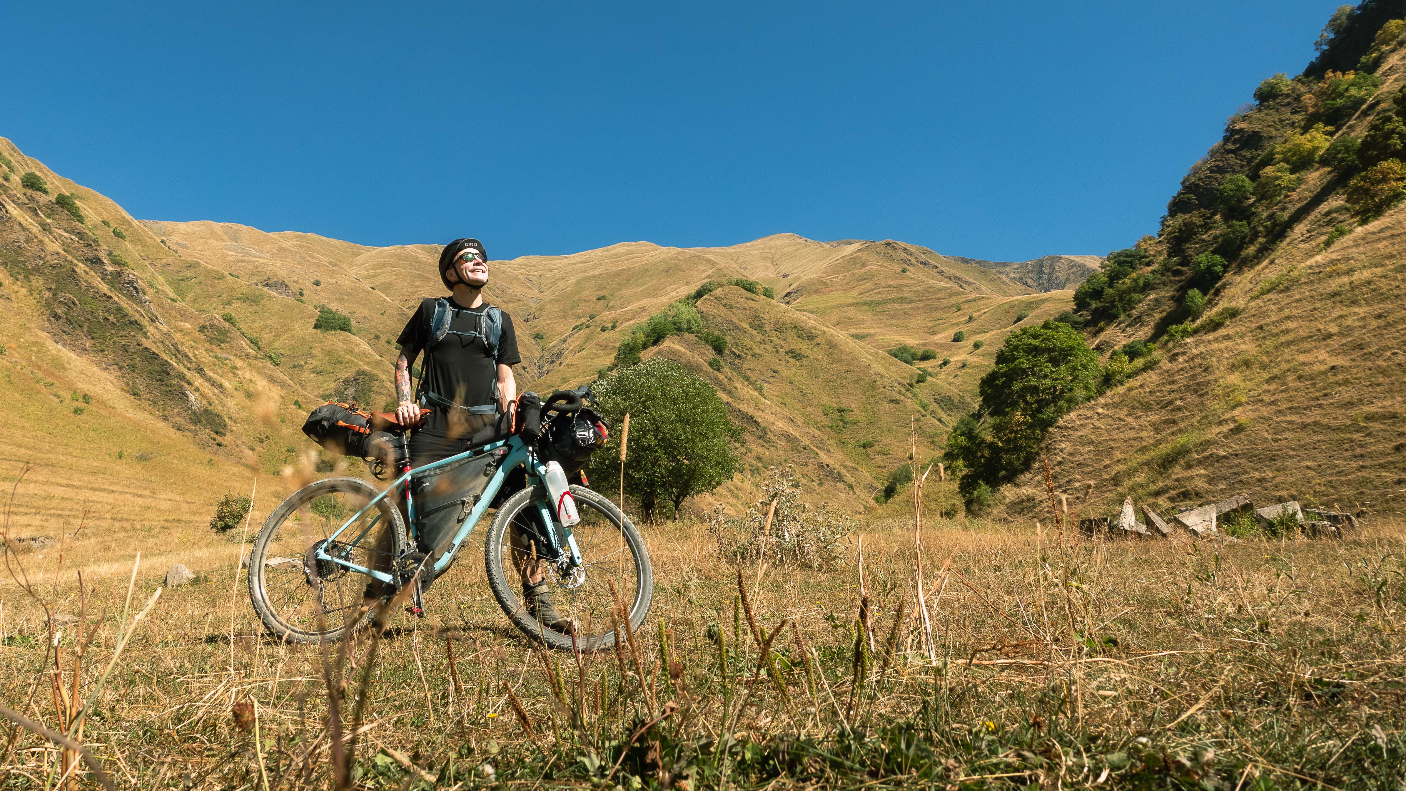
After finally finishing my huge Georgian breakfast, and umpteenth cup of coffee to get energised after a night of no sleep, I thank my host for storing the bike box for me and head outside to begin my ride. It’s already hot and sunny as I set off towards the outskirts of Tbilisi.
Still tired and somewhat confused from the lack of sleep, I navigate through the busy city streets dodging heavy traffic. Feels like a maze. There’s not a single other bicycle in sight.

Once out of town, my planned trail veers off-road and onto a steep uphill. Excitement of finally being on the road starts wearing off, and I begin to feel the weight of my the bike and heat of the day. My legs are already bleeding from the thorny bushes that seem to be everywhere (especially on the trail), and I’m worried about my drinking water situation. Checking the map, I see I’m supposed to be crossing a number of streams along the way, but it quickly turns out they’re all dried out this time of year.
Thirsty and exhausted, I eventually arrive at a dead-end. My map shows a trail continuing straight ahead, but there’s no sign of it in the thick bush in front of me. I’m looking obviously lost to the two men working on a construction nearby. With no common language, I signal for water and they nod, with one of them climbing down from the roof to fill up my water bottle from an unknown source behind the building.
This is where I start what I call the “dodgy water bottle” method. I have total 4 litres of water carrying capacity on my bike. 3 litres in a bladder in frame bag and 1 litre in a bottle attached to fork. The “dodgy water bottle” method consists of keeping the water in bladder always safe to drink, but liberally filling my bottle from all available sources (at times quite questionable) along the way.
Eventually, over the course of my trip, I end up needing to drink the dodgy water a number of times. When needed, I was really glad to have it. Purification tablets work wonders! Really want to keep my stomach intact for the long days in the saddle.
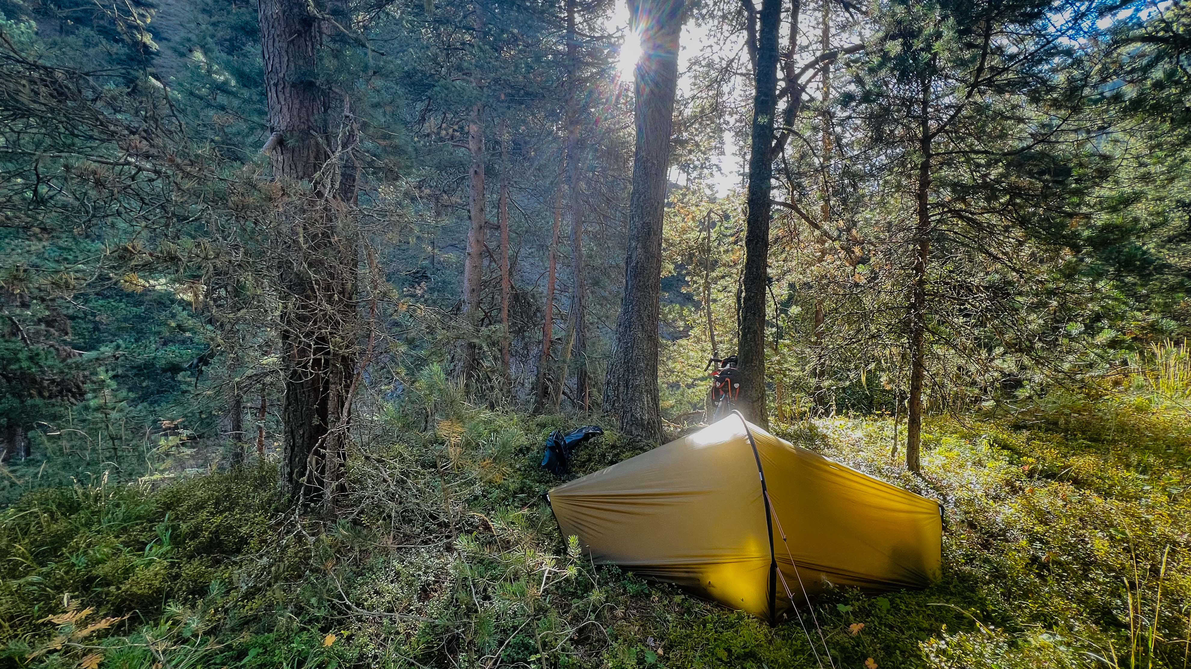
As the sun begins to set, I start looking for suitable campsite. Traffic is already non-existent. I continue cycling, mountain on my right, a flowing river on the left. Spotting a small road leading down to the river, I decide to set up camp there. Once the tent is up, I wash myself in the cold river in the light of my head torch.
Lying in my small tent, I can hear the river rushing outside and feel the cool wind on my skin. Exhausted, but happy, alone in the unknown, I close my eyes and drift off to deep sleep.

To Roshka
Road keeps following the river further north on a consistent uphill while the mountains around get increasingly majestic. Small villages along the road are getting smaller and smaller. There’s barely any traffic.
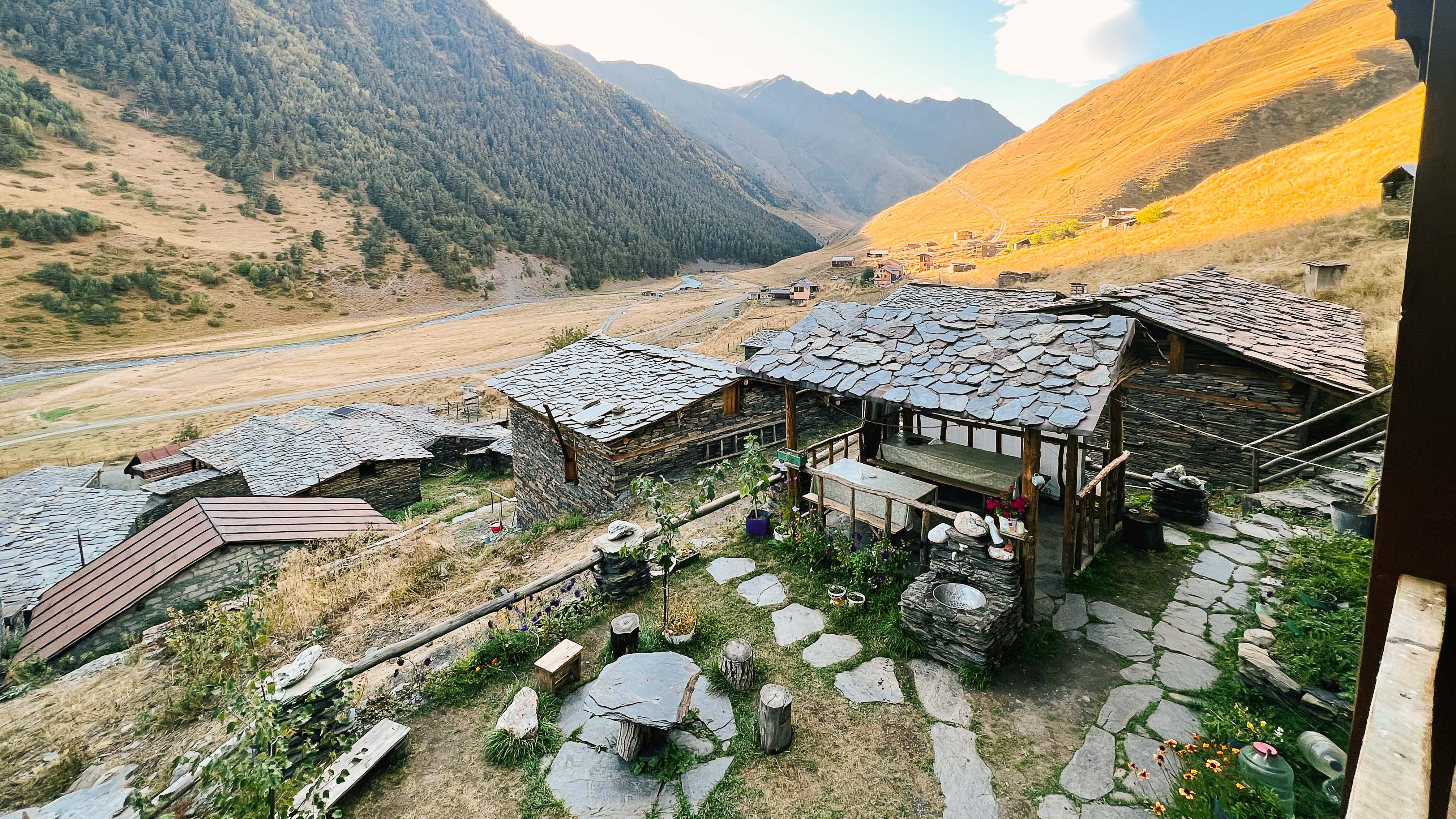
Around lunchtime, I pass an old wooden house with people sitting outside under the shade of a tree. Small sign at the gate is the only thing distinguishing it as a guesthouse. Someone waves me in and I push my bike through the small gate.
In the corner of the yard, I spot a cooking pan on open fire. As I signal for food, an elderly lady stands up, nods, walks to the pan, and returns with a plate full of small dumplings, khinkali. Just what I needed after a morning of uphill. Also the only option available on the menu.
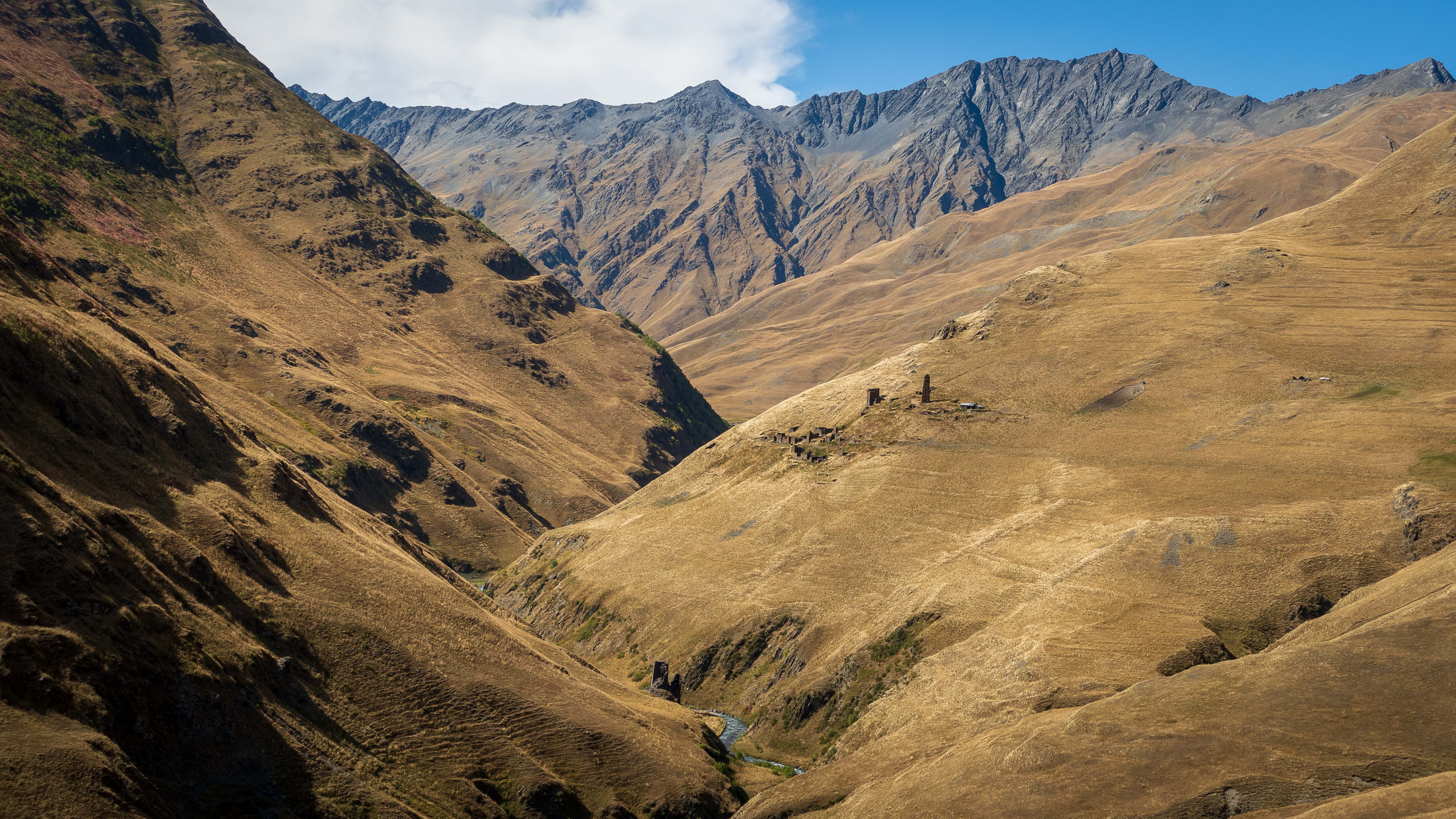
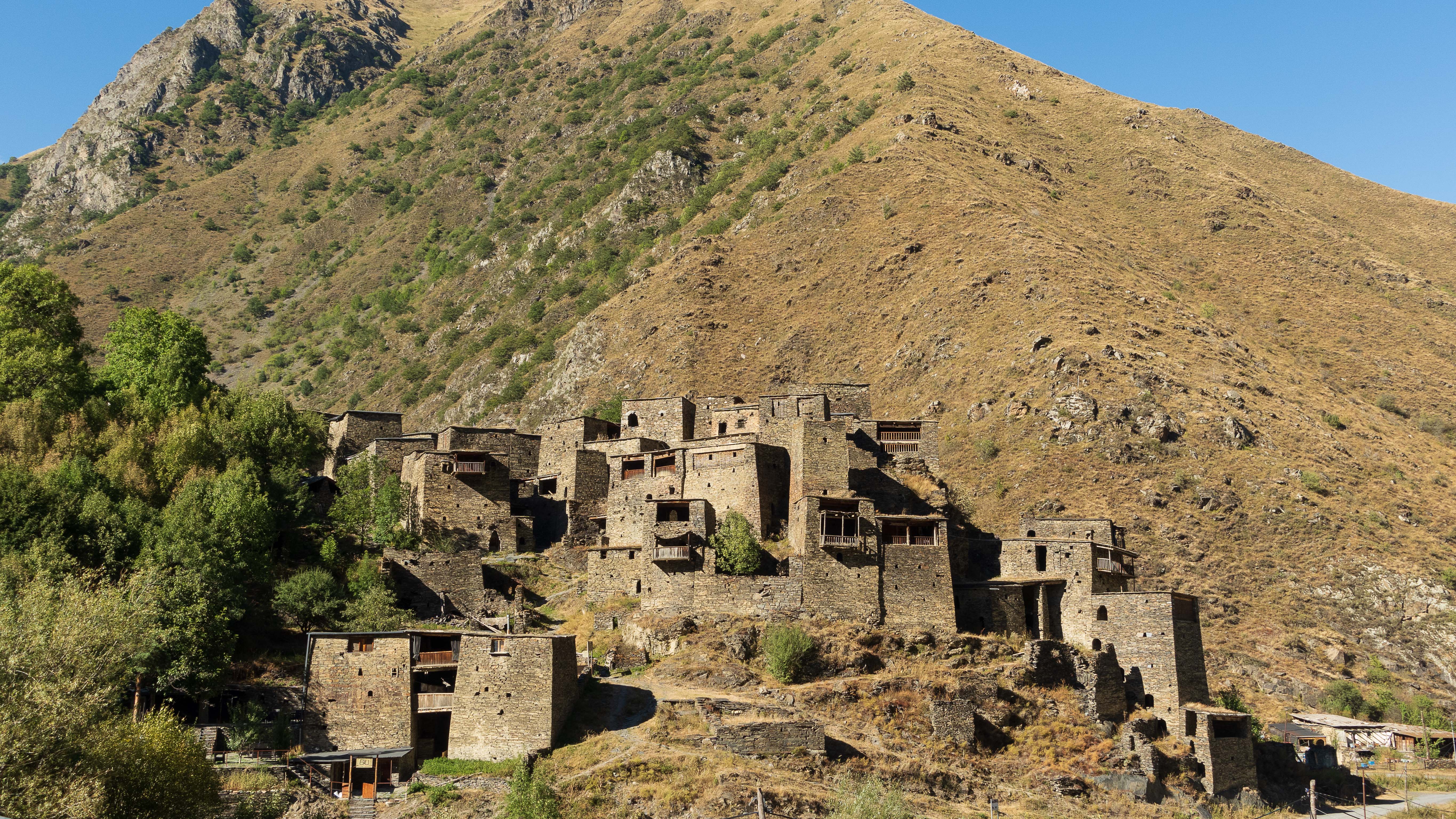
Later in the afternoon, my route turns off from tarmac to a dirt road ascending to the village of Roshka. Climb is bumpy and really steep, and I find myself pushing the bike more than riding it. Finally, after long climb and a river crossing, I see the tiny village ahead.
During the climb, I had already decided to ditch my original plan of continuing past Roshka and camping further up the mountain. Somehow, another full day at the saddle finished with the climb made the idea of large dinner at Roshka Guesthouse sound really inviting.
As I ride through the village at sunset, storm clouds are gathering in the mountains.
Roshka Guesthouse is completely empty, but unfortunately, they are not accepting any guests due to preparations for a large group arriving the following day. I’m directed to the only other guesthouse in the village where I’m the only guest. Host family sorts me out with a simple dinner and I eat alone looking out the window wondering if the storm in the distance will get here overnight.
As the darkness falls, village life quiets down. Lights turn off and everything is dark. Before crashing to my bed, I take a much needed shower in the guesthouse basement. Genuinely surprised the water is actually quite warm.
Lying in my bed in darkness. Cool mountain air flows in through the open window. I hear the storm building in the distance.
Missing Police
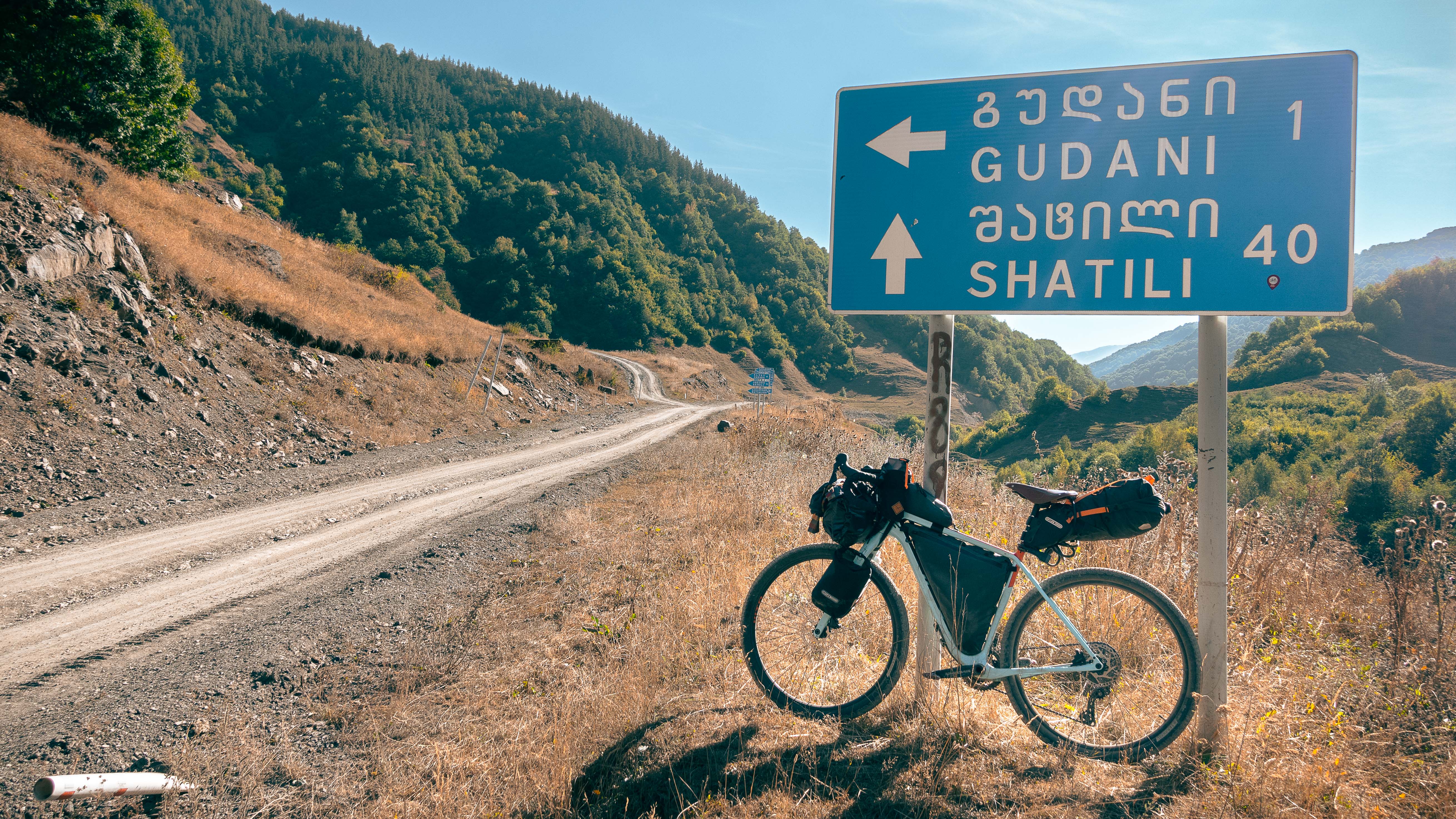
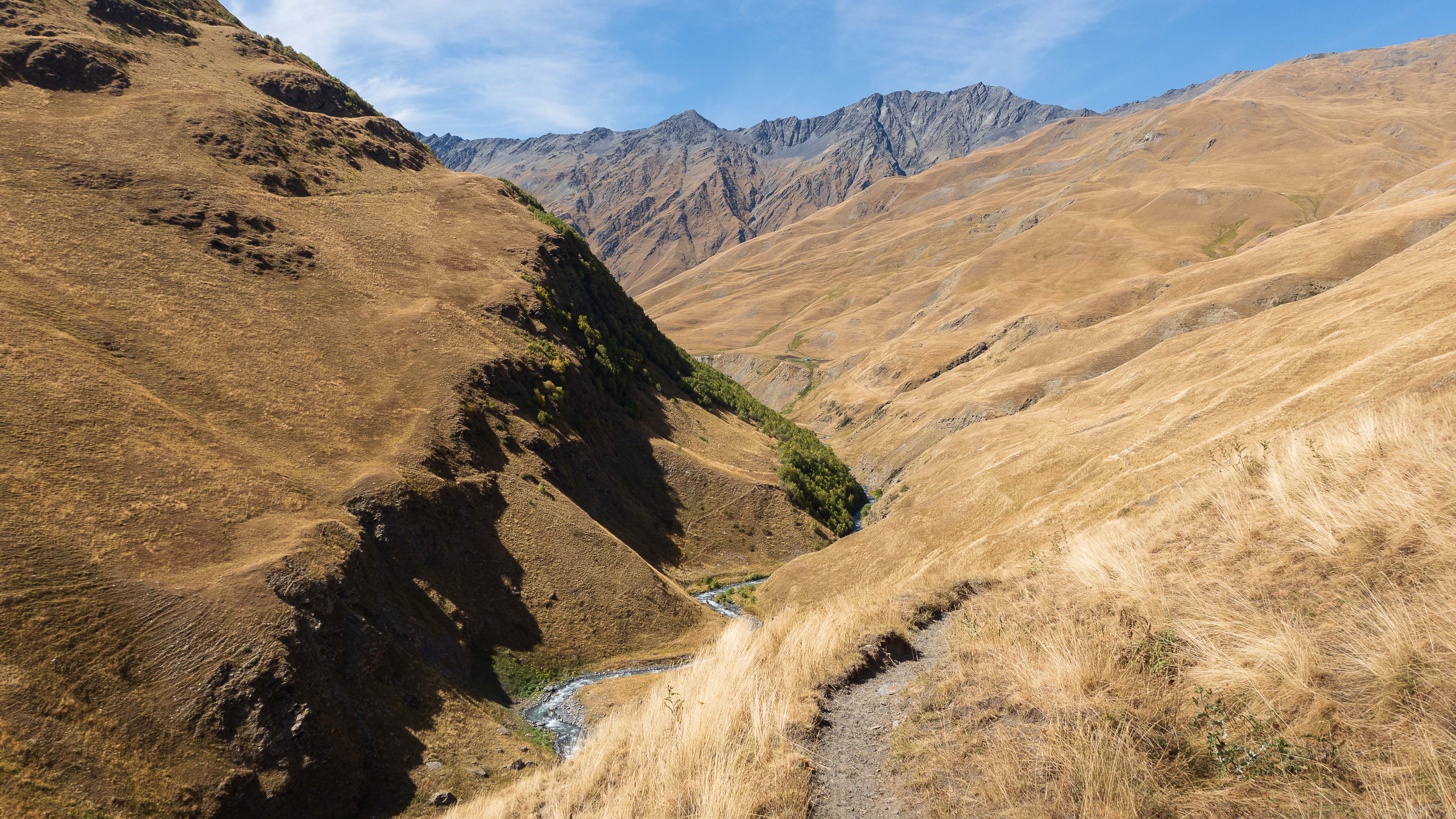
Next morning I set out early. After downhill back to main road, I turn towards east on a small dirt road to Shatili. It’s another sunny day.
As soon as the sun is properly up the temperature climbs to 30c even though I’m already well above 1500m altitude. Making sure I’ll have enough water for the mountain pass ahead, I stop for re-fills whenever I see a stream.
Everything is dry and dusty. My wheels raise small dust clouds as I ride, and slowly my sweaty skin is covered with visible a layer of dust. My black bike packs turn light brown, and I try not to open any of them through the day to keep the rest of my clothes and gear dust-free.
It takes me most of the morning and half of afternoon to climb to the first mountain pass of the trip at 2700m. The road zig-zags upwards on an exposed mountainside while the sun is boiling mercilessly above. There’s barely any wind. Hot.
Road is generally rideable with a very steep incline. I split the climb in short segments and regularly stop to catch my breath, constantly drinking to keep myself hydrated in the heat.
Every hour or two, a car appears, raising a big cloud of dust as it pulls alongside me. I breath through my scarf and wave for the smiling thumbs-up passengers. Most stop to ask if I’m ok, if I need water, and are generally curious of why on earth am I out here cycling alone. One even offers an ice-cream, which I keenly accept.
Even though it takes ages climbing up the pass, it only takes about an hour to get down the other side. It’s a long downhill and I happily coast on the empty road enjoying the breeze and much needed recovery for my legs. The only nuisance on the downhill are the dogs that seem to appear out of nowhere and give me a short chase before realising they won’t be able to catch me.
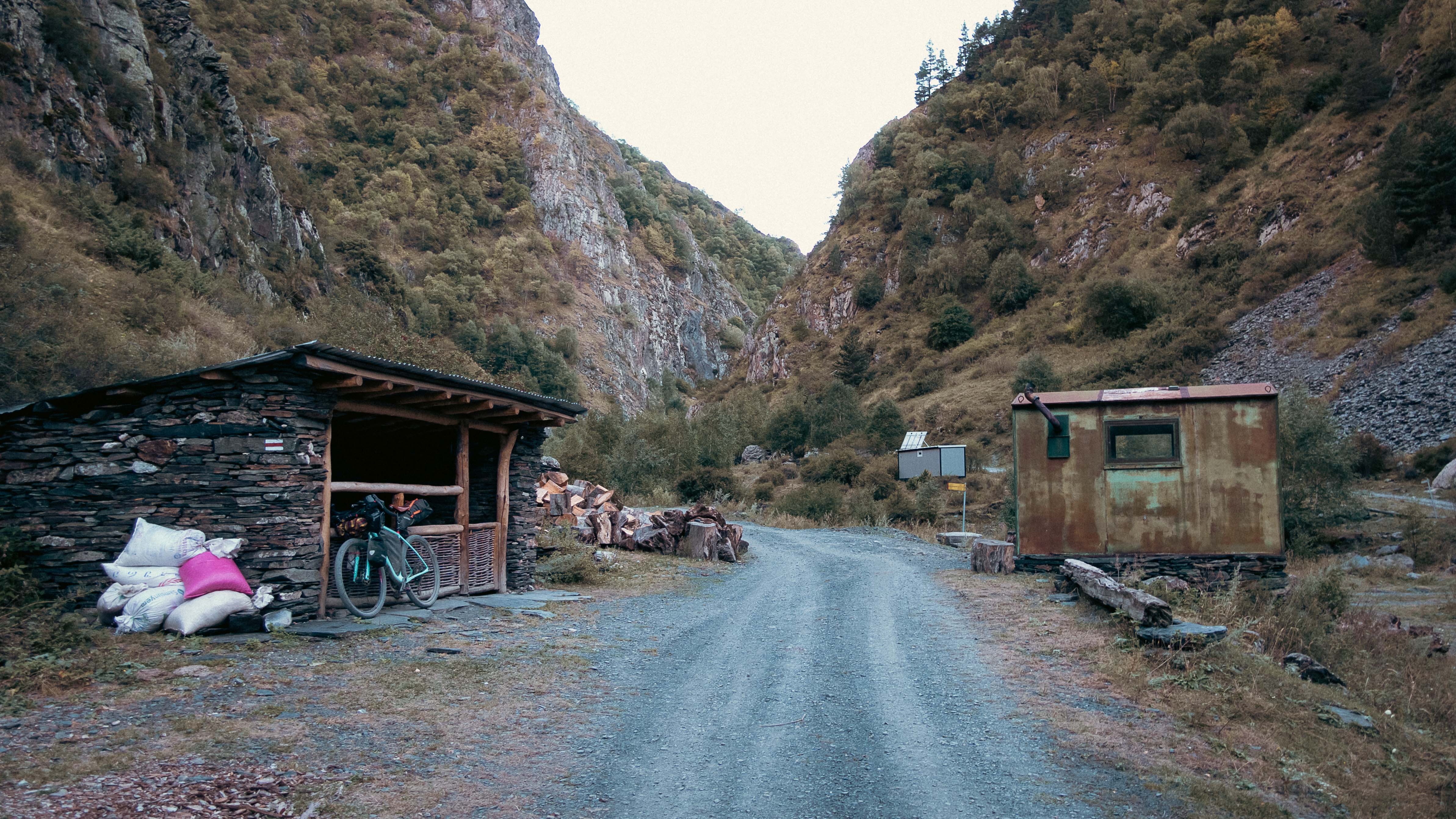
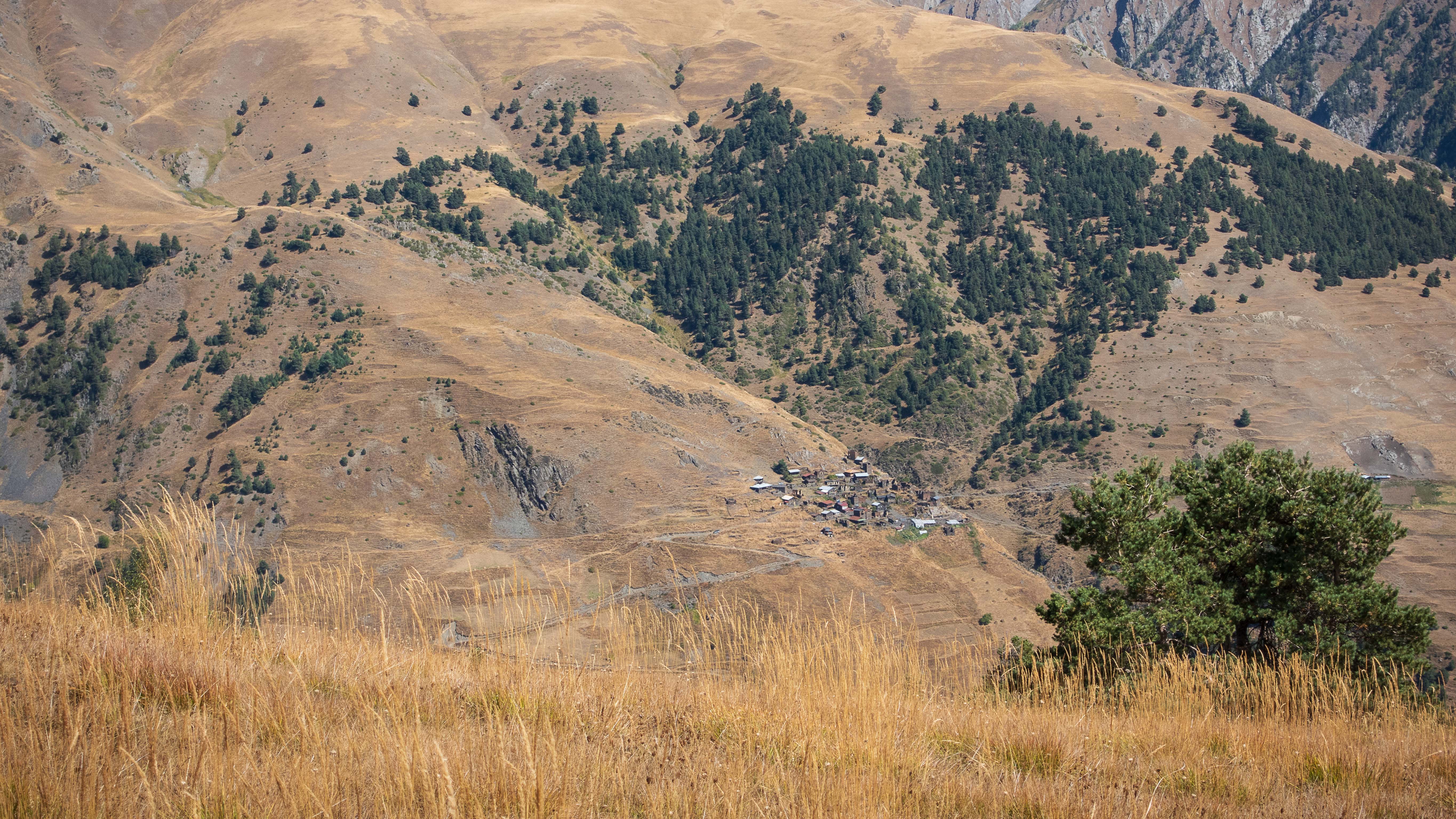
Shatili is the last small village before entering a long remote stretch while crossing to Tusheti. I stop for a big dinner and make one final check on my packed food situation. I should be fine for at least two days, maybe three, until I reach the first village in Tusheti valley.
I’m quite unsure how long it will actually take for me to get there, as there’s a big mountain pass and a lot of unrideable terrain ahead.

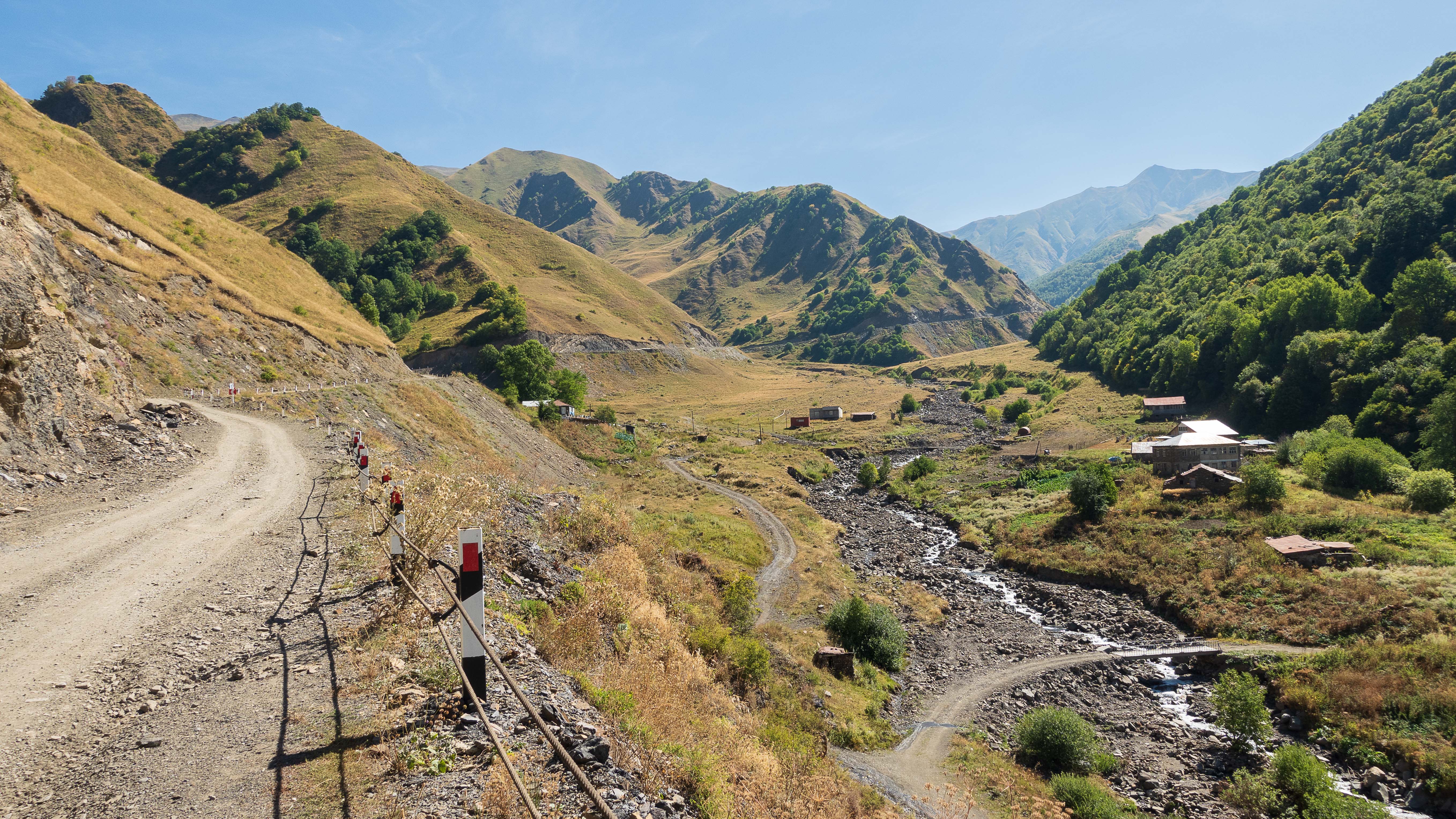
As the sun begins to set behind the mountains, I find myself cycling along a tiny dirt road next to small, flowing river. All is quiet, and I realise I haven’t seen anyone since Shatili on my afternoon dinner. The mountains around keep blocking GPS signal adding to the feeling of remoteness and isolation.
I’m approaching the Chechnya border, and after hours of riding in quiet, I hear a car approaching from ahead. Appearing behind the curve it’s a bulky border patrol jeep slowly crawling towards me on the bumpy road. Expecting an inquiry of my plans in the border area, I stop on the roadside waiting for them to reach me.
Based on my research, there should be a border police checkpoint about 10km ahead where I’m supposed to get my permit for entering the actual Chechnya border zone some time tomorrow. Ready to explain my plans, I wave at the approaching jeep. To my surprise, the two guards slowly pass me smiling and giving thumbs-up through open window. I climb back on the saddle and continue towards the checkpoint.
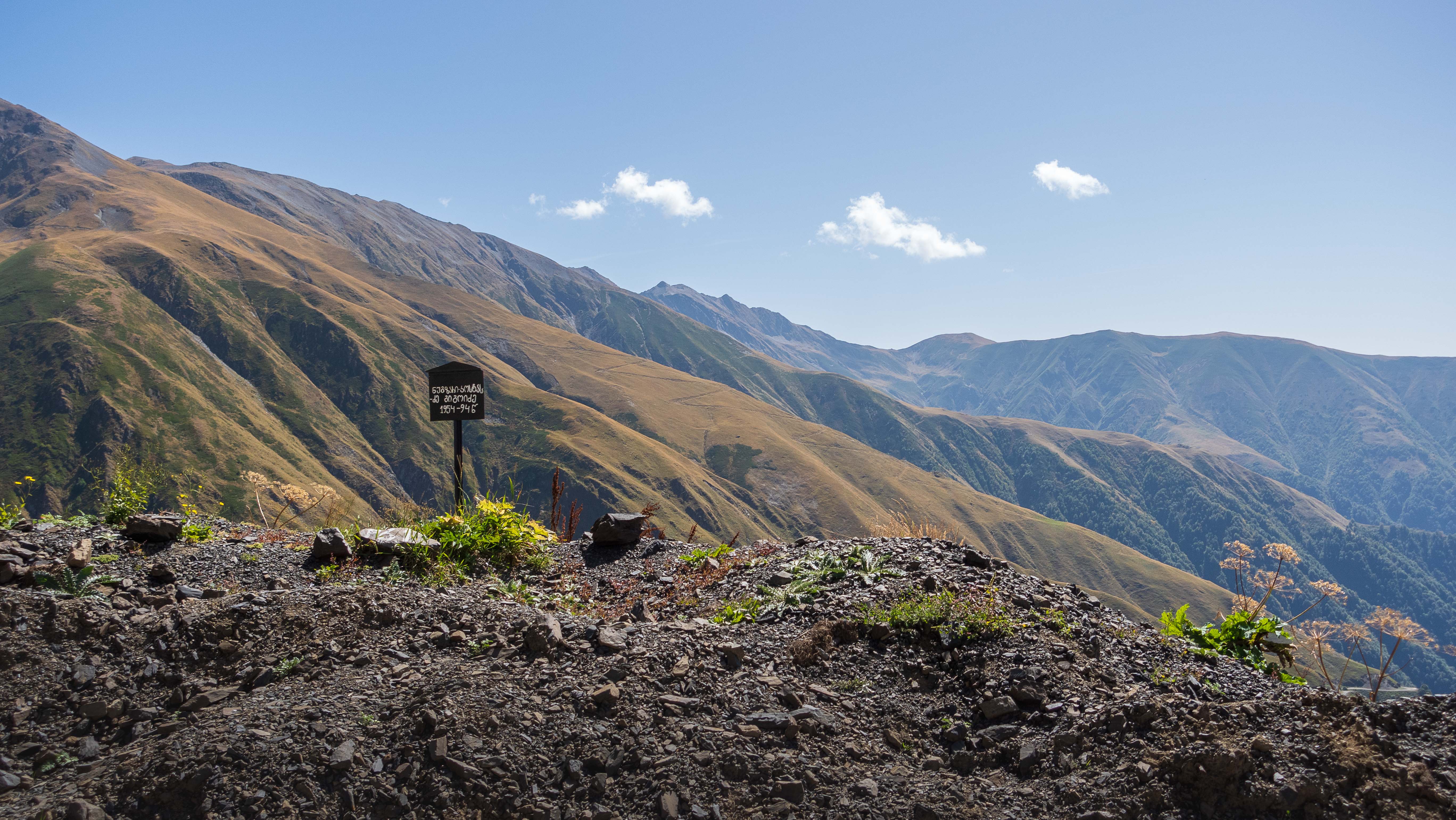
Soon I find the couple of small buildings alongside the road with “Police” written on worn-out wood. This is where I need to get my permits for entering the border zone, but there’s one slight problem – there’s no one around.
I leave my bike leaning on one of the buildings and walk around knocking the doors wondering what to do next. All the information I’ve read online before the trip was telling me to make sure to get my border zone permits here to be able to cross Atsunta Pass to Tusheti. If I continue without one, I’ll face the risk of getting turned back along the way. Or worse?

Not sure what to do, I decide to sit down, eat a bit, and deliberate my options. It’s already early evening, and I consider camping overnight at the checkpoint and wait if someone shows up by the morning. On the other hand – there’s still hours of daylight left. With tough days of hike-a-bike and climbing ahead, I don’t want to miss hours of potential progress. If I start falling behind my planned schedule already now, I’ll run a risk of running low on food before reaching the first village in Tusheti.
Eventually, I decide to risk it, and continue ahead. Consulting my map, I spot another border police checkpoint further up the mountain, and I figure I should reach it some time tomorrow. In the worst case – I’d miss a full day if I need to turn back from there to come back down for the permit.
Tired, worried, and quite frustrated of missing a key part of my plan (“make sure to get your border zone permits here…”) I cycle along. Every single source I found on internet before the trip told me to get my permit from here.
Small road leads me to river crossing at dusk. Water is icy cold and I can see the source, a snow-capped mountain, right above. I walk across barefooted, carrying my bike. It’s clear no car is able to pass from here. On the other side, the road quickly transforms to singletrack.
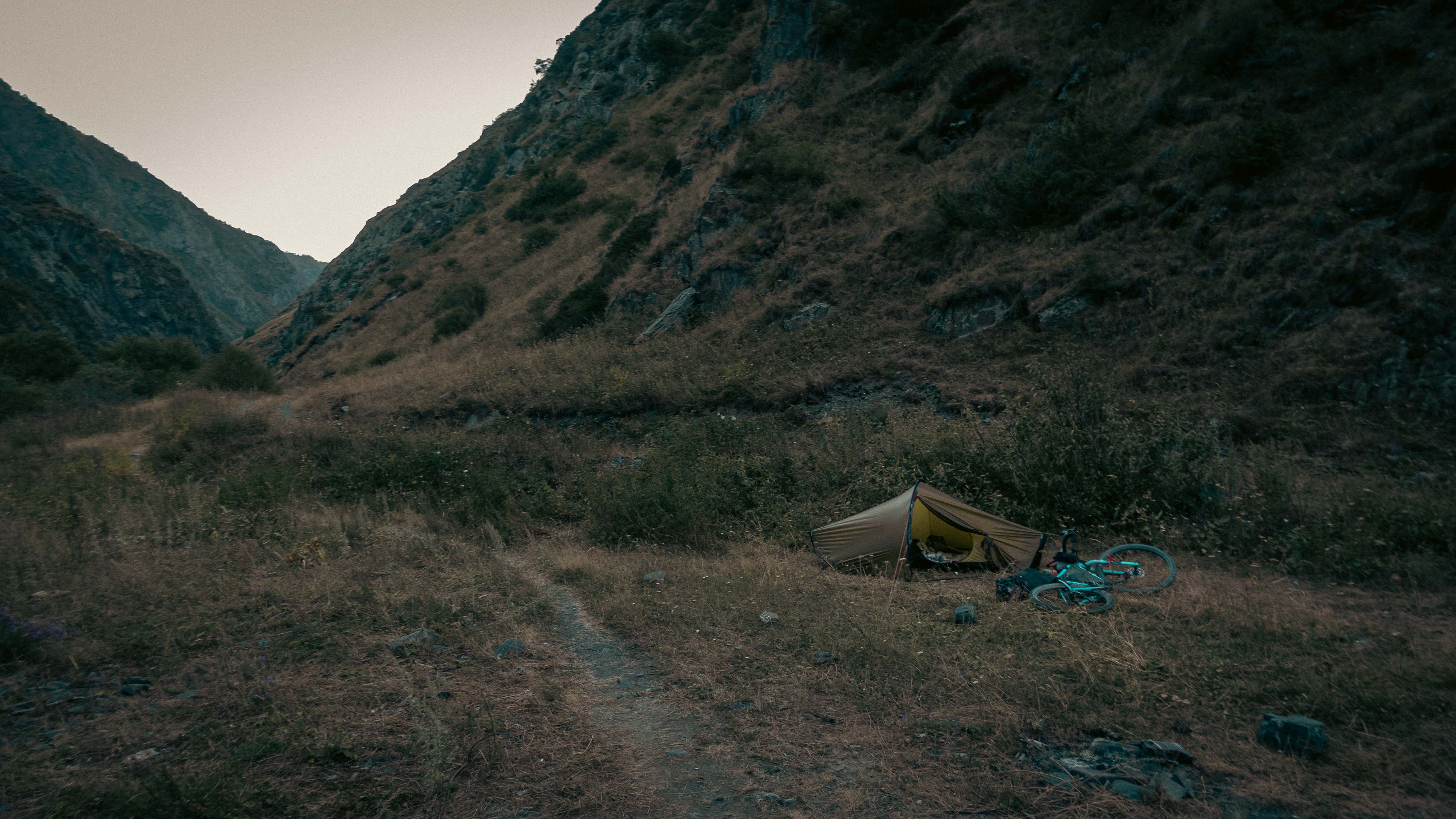
As it begins to get dark, I set up my tent by the side of the trail next to another stream. GPS remains blocked due to steep mountainsides in all sides. Isolation feels quite real.
Evenings get chilly this high up in the mountains. I cook myself a dinner watching darkness fall around me. Regardless of all the dust accumulated on my skin through the day, I’m too tired and cold to even think of washing myself in the river. As soon as I crawl to my sleeping bag, comfortable warmness lulls me to snoozing.
As I’m falling asleep, I hear a mouse moving around in the bush next to my tent. Hope it doesn’t find my energy stash on the bike.
To Altitude
Sound of an approaching horse wakes me up at sunrise. I drag myself out the tent and carefully stretch my muscles sore from yesterday’s riding. Horse stops beside my tent, rider looking genuinely surprised to find me there. Mix of sign language and smiles follows.
I motion him to stay for coffee, but he insists on continuing as offloading the stack of wooden planks balanced on top of the horse would be too much of a hassle. Sipping my coffee alone, I watch him cross the river and vanish behind the bend. I know I have a lot of uphill ahead of me today.
Atsunta pass is one of the highest mountain passes in Caucasus at 3470m, and only accessible by foot or horseback. It’s one of the two passes leading to the remote valley of Tusheti along Chechenya border. Knowing I have a day or two of hike-a-bike ahead, I shift all the heavy stuff from bike bags to my backpack, trying to make the bike as lightweight to carry as possible. With a heavy backpack and a somewhat lightweight bike, I cross the small river by my campsite and continue towards Atsunta Pass trail.
After less than ten minutes of riding, I arrive at another river crossing. This one looks deeper than the earlier ones and the water is rushing down rapidly. As I start to take off my shoes for a cold-feet crossing, another horseman appears from behind.
With a combination of sign language, pointing and nodding, he offers to carry my bike to the other side on his horse and points me towards a tree that has fallen across the river a bit further upstream. After a hair-raising balancing act on the trunk, I get to the other side with dry feet, and find the horseman waiting with my bike. Handing me the bike, he smiles and gallops ahead. I’m left standing by the river, amazed by the kindness of strangers in the mountains.
It doesn’t take long until the trail veers steeply upwards and diminishes to a tiny singletrack. I get off the bike and start pushing. Narrow trail forces me to either walk in the bush or drag my bike there. Neither seems optimal. I’m hoping it gets easier further up where I expect there’s not as much vegetation.
Climbing the steep trail with my bike quickly gets exhausting. It’s a frustrating combination of pushing the bike, carrying it, and checking my GPS in disbelief of how little elevation I’ve covered compared to what’s left ahead of me. The rumours of Atsunta pass being a gruelling hike-a-bike start feeling quite real to me.
The distance and climb ahead just feels too much to digest and decide to split my progress to short segments to make it more manageable. The longest segment I can think of covering on one go is ten steps. Ten steps, pause for catching breath while trying to keep my bike from pulling us both back down the mountain. Another ten steps, another pause. Not sure if I can make another ten – need a longer pause. Really…slow…progress. But I’m moving.
Through the climb, I have a consistent nagging of doubt in the back of my head – “What if the missing border zone permit forces me to go all the way back and do this all over again?”
After hours on the uphill, religiously executing my ten-step strategy, I finally get to the first plateau I’ve been waiting for. Even with roughly half of the climb still ahead, it’s a welcome change to get on somewhat even ground and take a moment to enjoy the views.
On the climb, I had been so focused on keeping the momentum going, I had completely missed the increasingly majestic scenery in every direction. There are mountains peaks all around, and in the horizon, I spot the area where I imagine Atsunta pass might be located. Even though it was hot in the valley, the temperature on the plateau at around 2600m altitude is already chill. There is constant breeze with occasional strong gusts.
Finally, I spot the border police station ahead of me. I climb on the bike and cruise down the hill with a mix of excitement and nervousness. This is the moment of truth when I’d find out if I’ll be able to continue ahead or if I need to turn back to get the permits from the earlier checkpoint way down the mountain.


As I approach the buildings, several soldiers step outside to meet me. One has binoculars hanging from his neck, and I assume he has spotted me on the climb a long time ago. They’re all dressed in thick jackets and their dark skin tells the story of being exposed to the sun and elements for quite a while.
The whole encampment consists of just two buildings, a tent, small fence, and water source which I’m already planning to visit as the soldiers approach me. I find myself wondering what the border guards’ life might be like up here, staying extended periods on the remote mountainside.
After a lot of hand-shaking, thumbs ups for the bike, and a quick visit to the water source for some fresh, cold water, I finally discover that I actually can get my border zone permit from here, and will be able to continue onward. Phew! The soldiers seem to sense my relief and smile.
Some paperwork, broken english, and sing language follows in windy conditions. Once all is sorted, I continue up the mountain fully stocked with fresh water and the long-awaited border zone permit in my pocket. Soldiers stand outside by the buildings, watching me slowly disappear behind another hill.
Tiny trail continues inching upwards, and late in the afternoon, Atsunta Pass finally comes fully into view. Even after all the climbing, the pass is still ominously looming high above me.
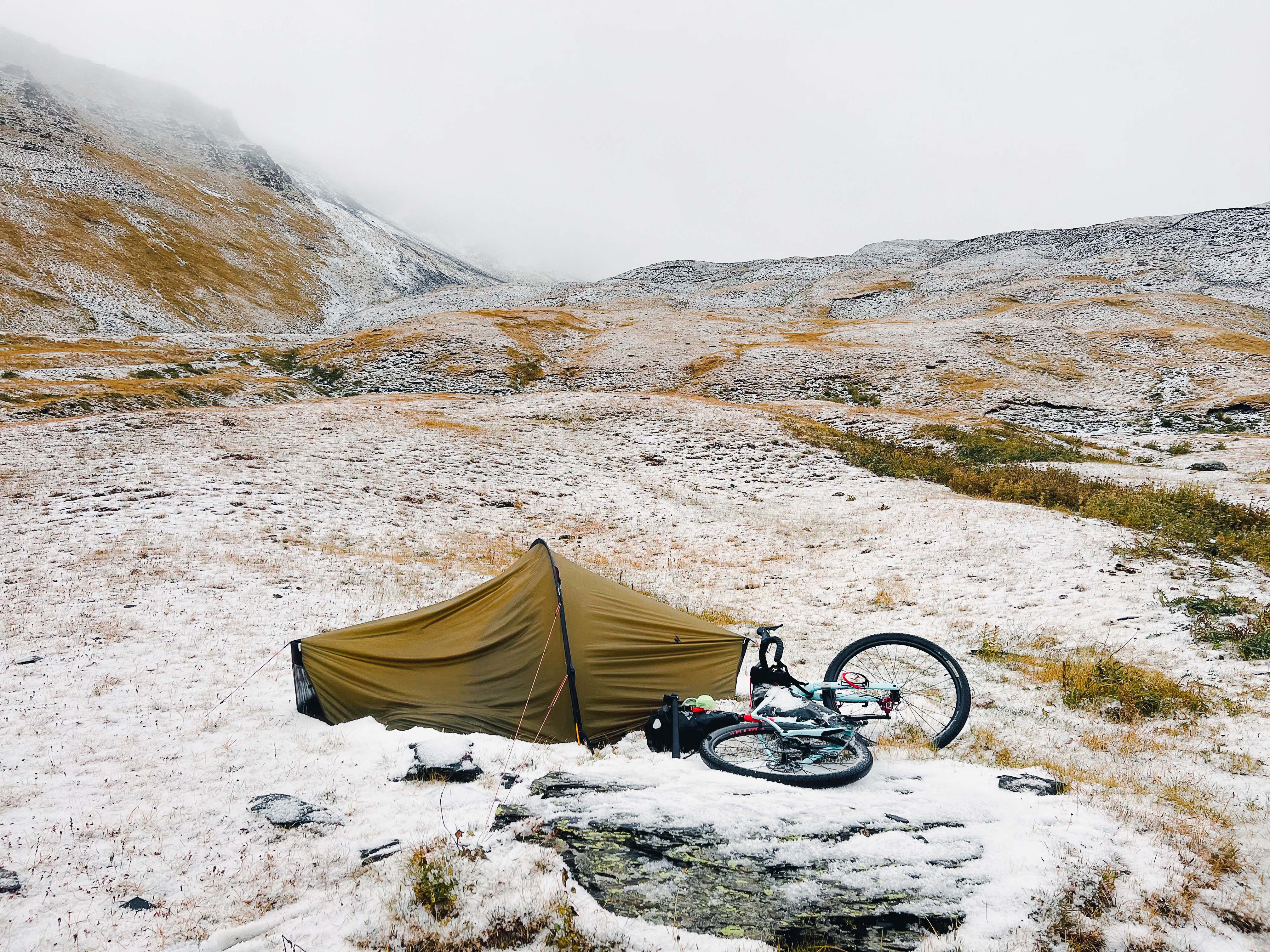
Around 4PM, I finally conclude I won’t be able to make it all the way up the pass and down the other side during daylight. Not wanting to stay overnight any further up the mountain, I decide to set up camp at next stream I spot on my map to be able to re-stock on water.
As I approach the blue line marking a stream on my GPS screen, I quickly realise it’s not actually a stream. This time of the year, there’s only a tiny bit of water dripping between rocks. Someone has cut a plastic bottle in half and installed it in the mountainside to provide a way to gather the dripping water. I fill up my reserves worried the stream might be all dried up by the morning.
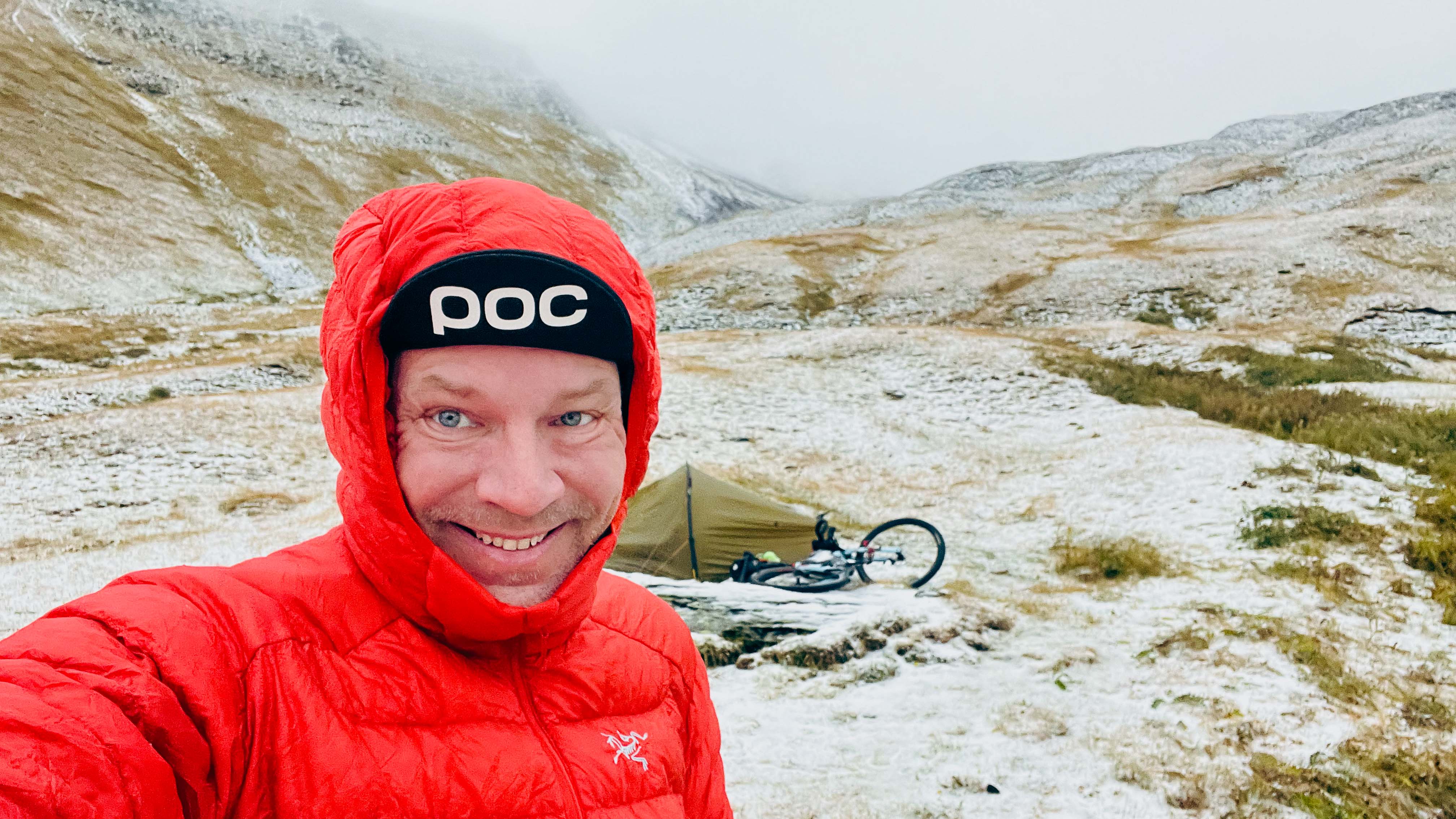
Extremely tired after full day of climbing, I look for somewhat even ground by the trail and set up the tent at 3000m altitude. Wind has calmed down and it’s all quiet. Atsunta Pass is looming peacefully about 500m above me. With no wind, I sit on the rock outside the tent wearing shorts and T-Shirt while cooking and reading a book on my phone.
Knowing I’m camped in altitude on an exposed mountainside, I decide to check weather forecast for the upcoming night on my satellite communicator. To my great surprise, forecast for my location is predicting thunderstorms and heavy snowfall through the night. Hard to believe considering the current conditions.
After triple-checking my tent pegs, getting my rain gear ready, and making sure everything outside the tent is properly attached to the bike, I enjoy the spectacular sunset from the warmth of my sleeping bag.
Better get some sleep before storm arrives.
The Storm
I wake up to a loud rumble in complete darkness. Series of lightnings flash all around. Wind and rain are pummelling the tent. Not sure how I managed to sleep for this long as the sound of the storm seems to be everywhere and I feel like I’m waking up in the middle of a war zone.
Never experienced thunder this close. Ground trembles and constant lightning strikes keep illuminating up my dark tent, showing flashes of what feels like chaos. Wind keeps pushing the tent canvas inwards. Rain and wind are really loud, punctuated by the rumble of thunder that seems really, really close. I try counting the seconds between flash and sound, but the sound seems instant.
At least I’m still warm and dry in my tent. Just really scared.
Regardless of the gusty wind, my tent seems to be holding up. At least for now. I try to calm myself down with the fact that I’m still warm inside my sleeping bag. As long as things stay like this, I should be fine. The storm will eventually pass. Really hope the lightnings don’t hit my tent which is the only structure on the otherwise flat mountainside.
Thunderstorm continues for hours. In my tired state of mind, trapped in the tiny tent surrounded by darkness and violent storm, I feel alone and powerless.
After hours of listening to the thunder rumbling above and tent canvas flapping in the wind, I eventually drift off to restless sleep – just to wake up to the next lightning strike.

Next morning it’s still raining. Thunder and wind are gone though. Tent is hanging sagged close to my face, but everything seems dry inside. Still tired after the storm, I pull the sleeping bag around my head and continue sleeping.
Eventually, I decide I need to get moving. I want to get down from altitude at daylight. It’s still raining outside, and when I peek out the door, I realise the tent is surrounded by snow. After a breakfast of cold porridge and an energy bar enjoyed in the warmth of my sleeping bag, I finally pull on my rain gear and step outside.
Atsunta Pass above me is covered in could and there’s snow all around. Where there was a trail just yesterday, now seems to be just a blanket of sleet covering the mountainside. I pack up my wet tent, and with my wet feet already starting to freeze, start pushing the bike through the sleet.
500m of additional elevation to cover before the trail should start veering down to Tusheti valley.
Across Atsunta Pass
Progress is slow. I alternate pushing and carrying my bike, but neither seems optimal. The higher up I get, the more snow there is on the trail and the more difficult the progress. Feet are already soaking wet and I’ve lost feeling in my freezing toes.
Toughest thing I remember doing in a long, long time – possibly ever.
My progress is again diminished to 10-step intervals with long periods of recovery in-between. Standing still only worsens my toe situation. Snow gets stuck on the wheels adding to the weight of the bike. Every now and then, I peer down the steep slope, and see last night’s campsite getting smaller and smaller below.
There are sections where wind has backed the snow to knee-deep piles extending all the way to the edge of a steep cliff. I’m worried of either dropping my bike or slipping down myself. Or both. Any form of help is quite far away. I haven’t seen anyone since the soldiers at the checkpoint a day earlier, and I doubt anyone else is out on the trail due to the storm last night. Making sure my satellite communicator is easily accessible for emergencies, I continue inching forward.
GPS navigator is an unforgiving piece of technology. On an ascent like this, exhausted from days of climbing, pushing, and carrying the bike, it’s really excruciating to know exactly how much distance and elevation there’s still to cover before reaching the summit.
Eventually, my thinking boils down to constantly evaluating if I’m able to continue my current suffering long enough to make it all the way to the top, or do I need to turn back, re-establish camp, and try again the next day with hopefully less snow. Decision of turning back would save my poor frozen toes and make sure I don’t fall off the frozen cliff, but equally – I’d risk very probably running out of food before reaching the next village.
Finally, when my GPS navigator is showing less than 500m distance to the highest point, the pass finally becomes visible through the cloud. Wind is howling directly from the front, through the narrow pass between two peaks. It’s still raining. I summon all of my remaining willpower to push against the wind and rain, maintaining the 10-step intervals between pausing for breath.
As I finally drag myself to the snow-covered Atsunta Pass sign, I feel a sense of relief. It’s all downhill from here! I only pause for a minute of shooting a quick video by the sign before continuing to push my bike down the snowy mountainside on the other side.
It’s really cold. Need to get down fast.
Crash and Lamb
Trail is equally snowy on Tusheti side of the pass, but progress is much easier downhill. At times, I even decide to jog alongside my bike trying to get my frozen feet back to life.
Below 3000m altitude, the blanket of snow gradually starts to get thinner. Eventually, I’m walking down a wet and muddy trail, suddenly realising it’s actually quite a smooth one (though still wet and muddy) – maybe even rideable! Without much thinking, I jump on the bike and start a wobbly descend further down the valley.
With most of the weight high up in my backpack, my riding is quite unstable, and I find myself thinking, “I need to ride really conservatively as any accident can turn disastrous in these very remote surroundings“.
As soon as I finish the thought – quite proud of my responsible way of thinking – my front wheel slips. Before even realising what’s happening, I’m landing head first on the trailside. My helmet hits a rock and I lay down on the ground confused.
Slowly getting my bearings, I carefully lift my head. I feel dizzy, but rational. Bike is lying on its side next to me. My head is spinning, but things are slowly coming to focus. As the shock starts to wear off, I carefully begin to assess the damage.
Legs seem alright. Some slight pain in left hip. Left shoulder hurts quite a bit, but I can still move both my arms. Head was hit, but I think helmet saved me from most of it
Am I able to stand up? What happened to the bike? Did my journey end here?
I slowly get up. Left shoulder is really hurting. Digging for some painkillers stashed in my small first aid kit, I assess the bike situation. One of the bags attached to fork has detached and is lying in the grass. Rest of the stuff is still intact. Handlebar has turned to unnatural position around its axle, and right break lever is pointing to funny direction. Both should be fixable with a bit of adjustment. Other than that – everything seems functional.
Breathing a sigh of relief, I take my painkillers and climb back to the saddle. With much less speed this time, I continue wobbling down the mountain. My shoulder is sending spikes of pain reminding me of the injury on every bump along the way.
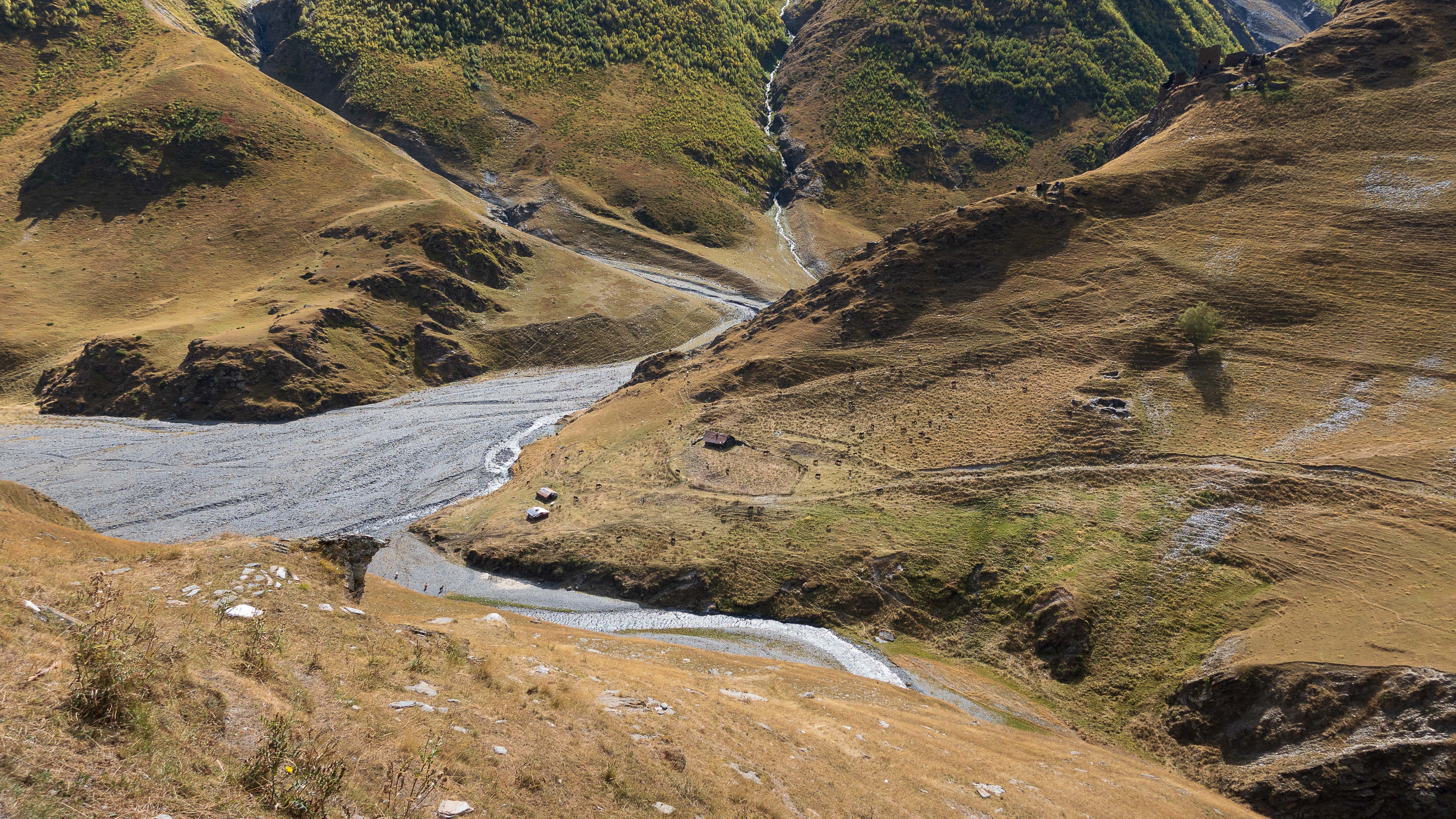
As my frozen toes are finally starting to show signs of life, I’m again faced with another river crossing. Stripping down to underwear, I make two rounds across the river – first with my bags, then with the bike. The river is the deepest one this far, and once done, I’m soaked from waist-down. With my yet again numb feet, I continue downhill along the river alternating riding, pushing and carrying the bike.
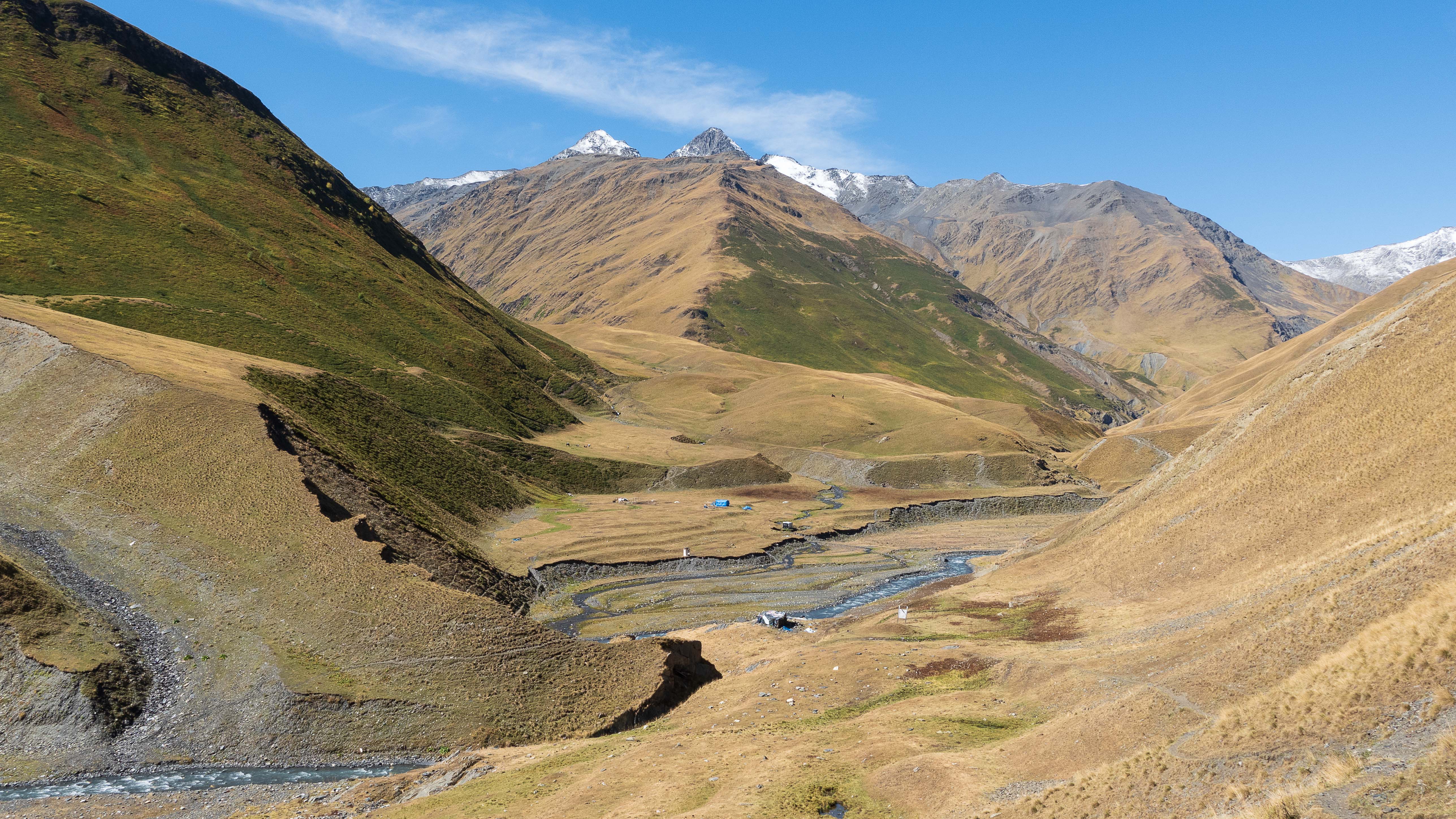
My original plan for the day was to reach the first small village in Tusheti called Girevi. However, with just a couple hours of daylight left, I come to realise I probably make it all the way there before dark.
As I arrive to the shepherd camp of Kvakhidi Meadows, I stop to consider my options.
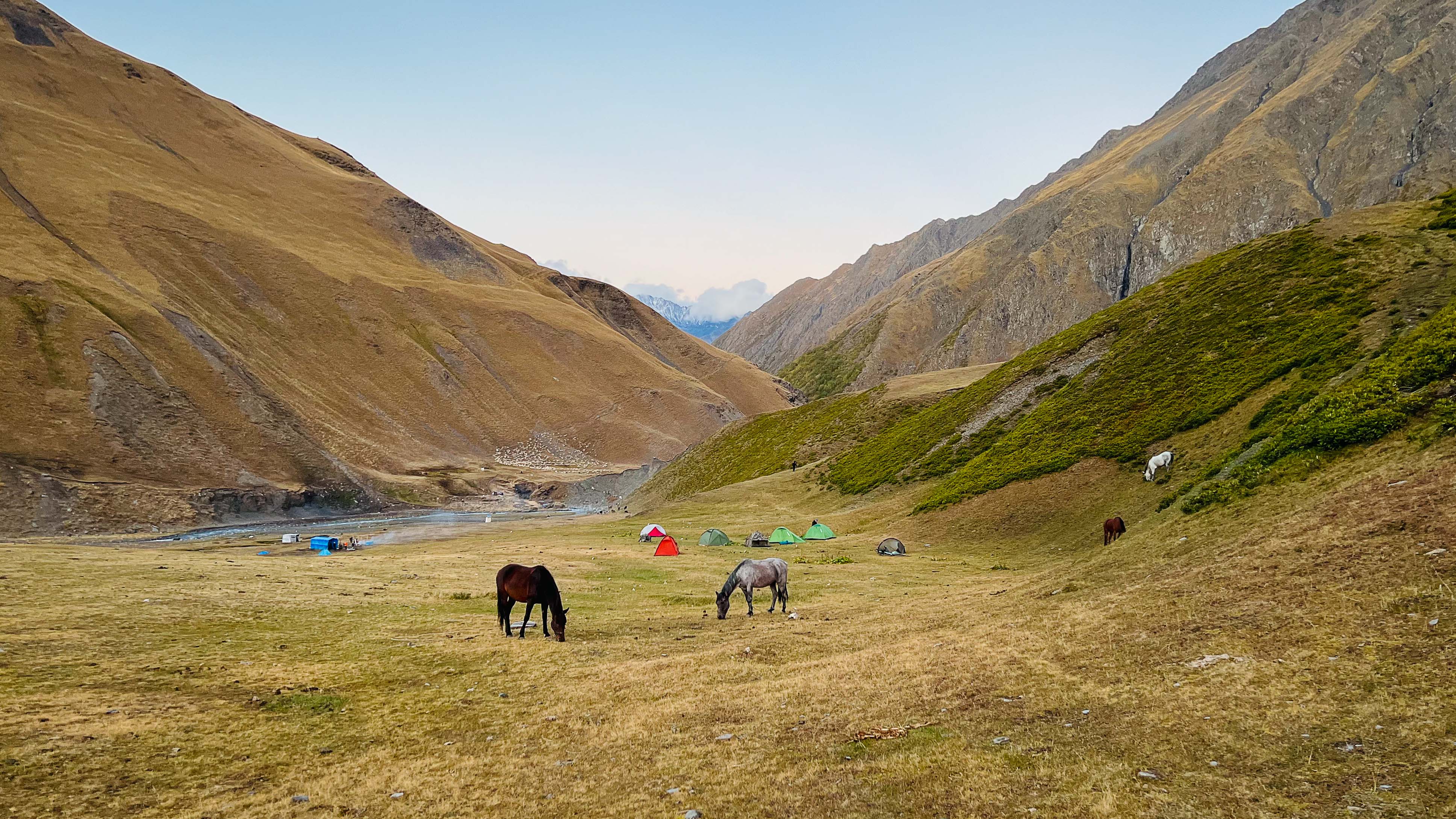
Already low on food, I’m really tempted to keep moving and trying my luck. Luckily, a group of Latvian hikers, the first people since the border guard checkpoint, tell me it took them a full day to get from the village to where we are now. Even though I’m with a bike, they assume I’d be pushing or carrying it most of the way, and therefore shouldn’t expect to cover the distance much faster.
What finally convinces me to stay at Kvakhidi Meadows is the news that the Latvians had just purchased a lamb from the shepherds at the camp. Their plan was to cook a huge dinner out of it and I was invited to join! Having been constantly hungry for several days, it’s really hard to pass such an offer, and I happily set up my tent next to their camp a bit further up the hill.
Later in the evening, when sharing the freshly cooked lamb over campfire, the Latvians tell about their initial plan of crossing Atsunta Pass today. Apparently, their guide had not allowed them to proceed due to risky conditions with snow up there. Good call.
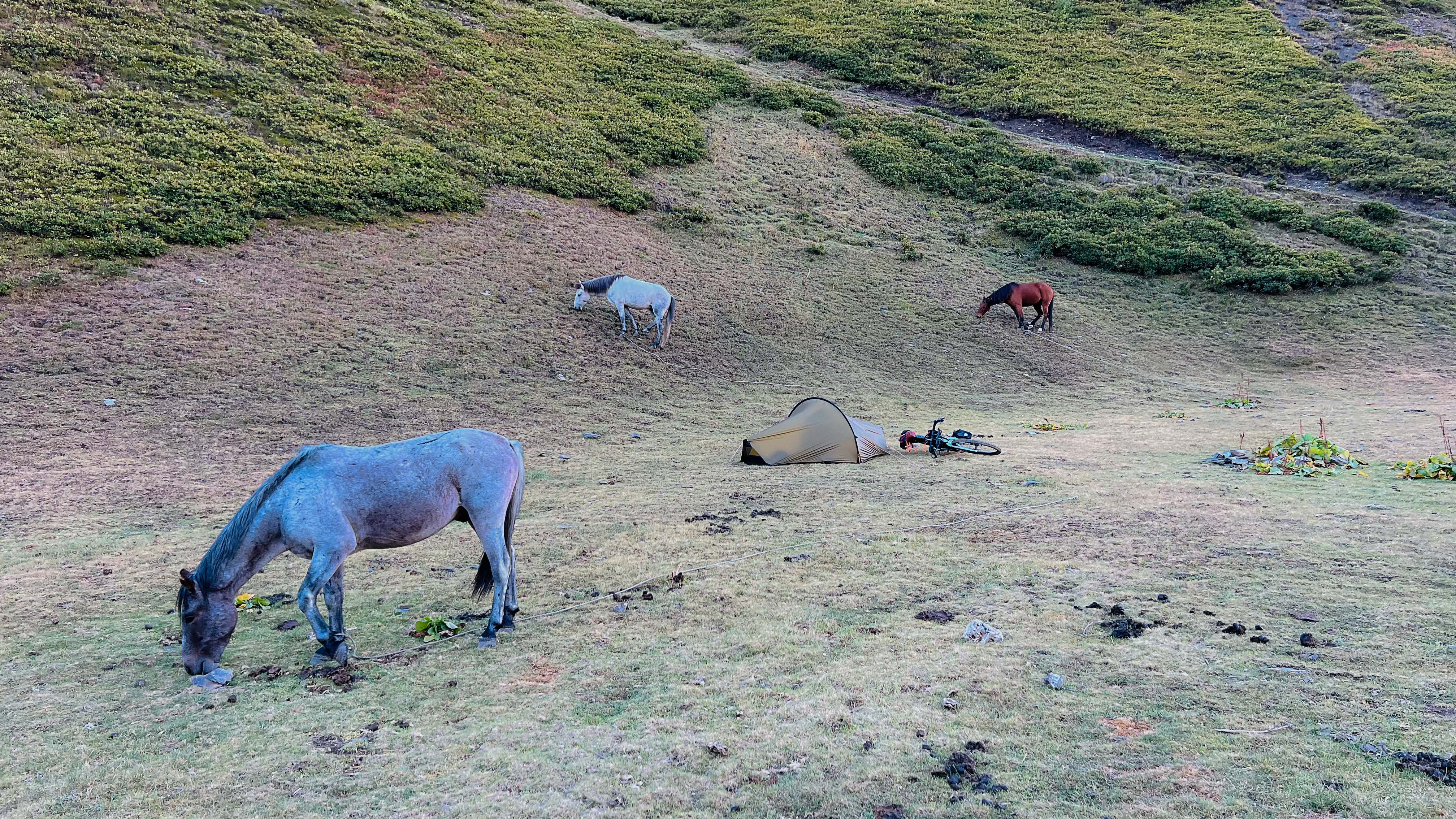
With stomach full of lamb, I retreat back to my tent early, and quickly fall asleep listening to the horses wandering around.
Sheepdogs
At night, the temperature drops well below zero, and by the morning, everything is covered in a layer of frost. I wait in the warmth of my sleeping bag for the sun to rise high enough to start warming my tent. A group of sheep are already enjoying the warmth on the opposing mountainside.
Quite sure I’d reach the village by the evening, I decide to have a luxurious breakfast of double-porridge and some coffee. Pretty much the last remaining food I have on me.
The Latvians are already getting ready to continue their way to the pass. They repeatedly warn me about the sheepdogs they had met along the trail. One of the guys had actually been bitten by one a couple days ago. I get increasingly worried.
My dog-safety plan is simple. First line of defence is making sure the bike is always between me and the dog(s). Unless they decide to surround me, the bike should provide at least a bit of cover. I had used this strategy already on earlier days for the occasional smaller dog along the way. However, the rumours of fierce Tushetian Sheepdogs the size of a small cow, still kept me on my toes.
If the bike cover isn’t enough, I always have the backup of using my sturdy GoPro El Grande pole as a baton for threatening any approaching dogs. If that still wasn’t enough, I was hoping there would be small stones available for further intimidation.
In no scenario, was I actually planning to physically engage with the dogs, so it was all more of a mind game. I wasn’t going to blink first.
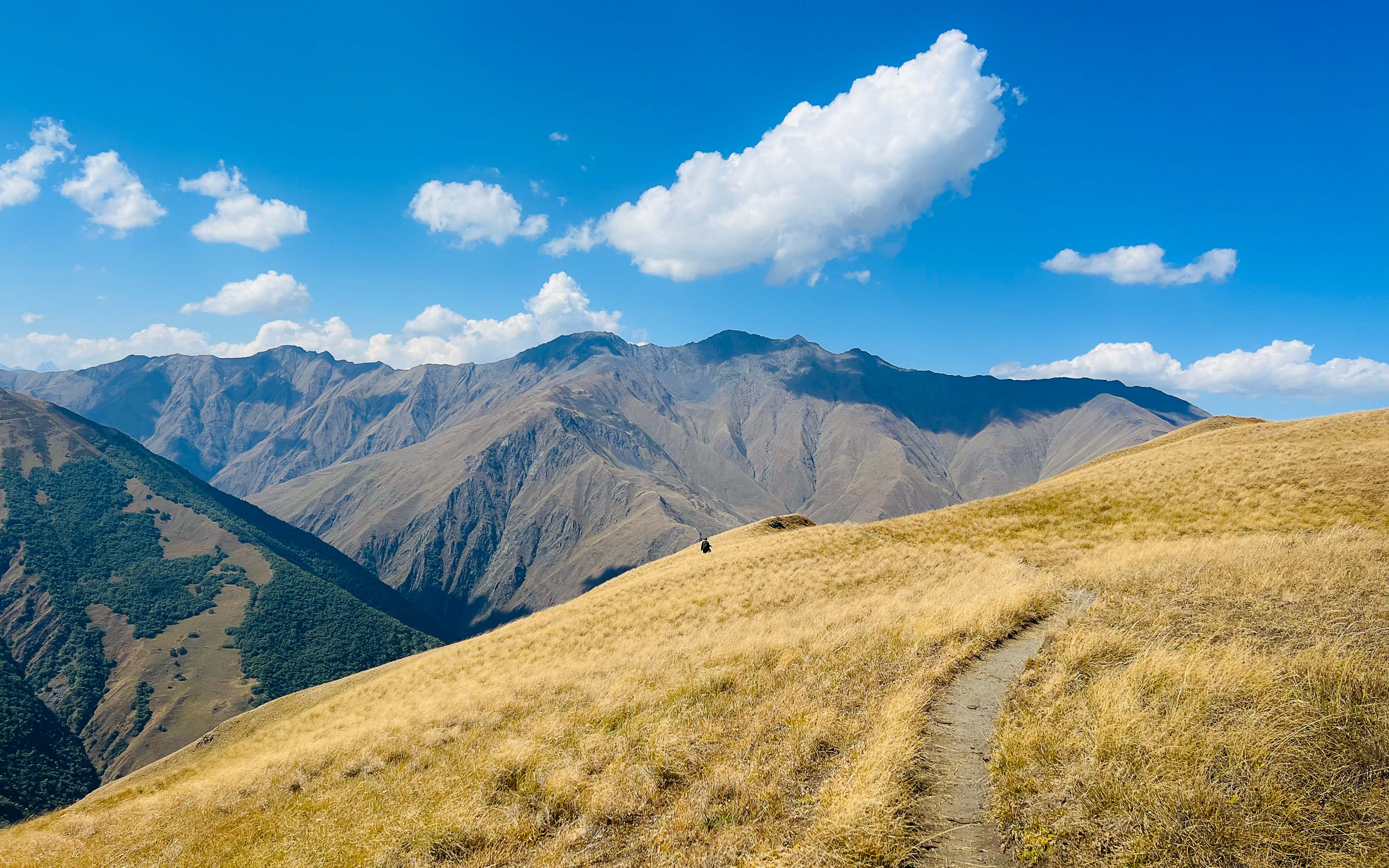
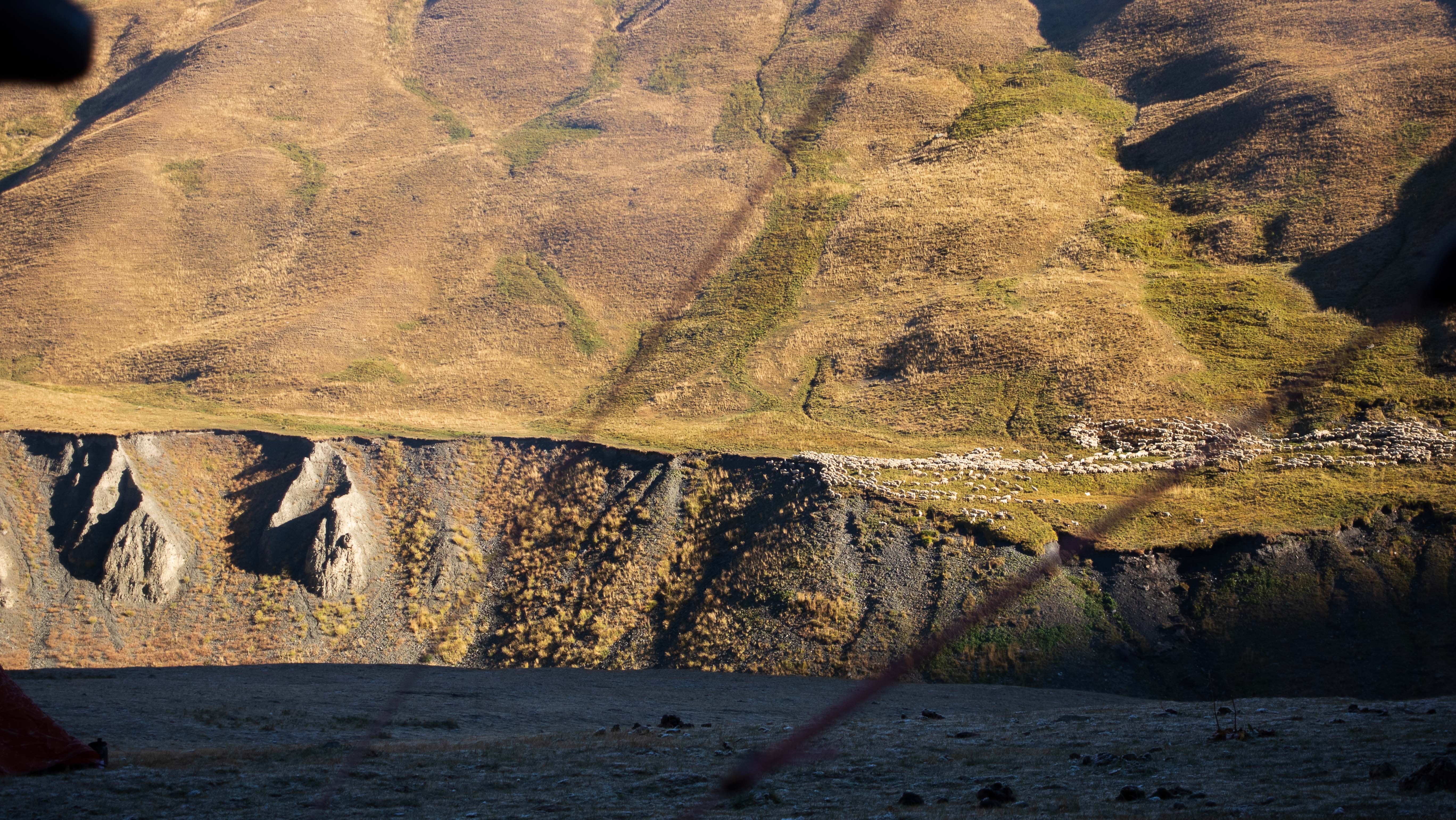
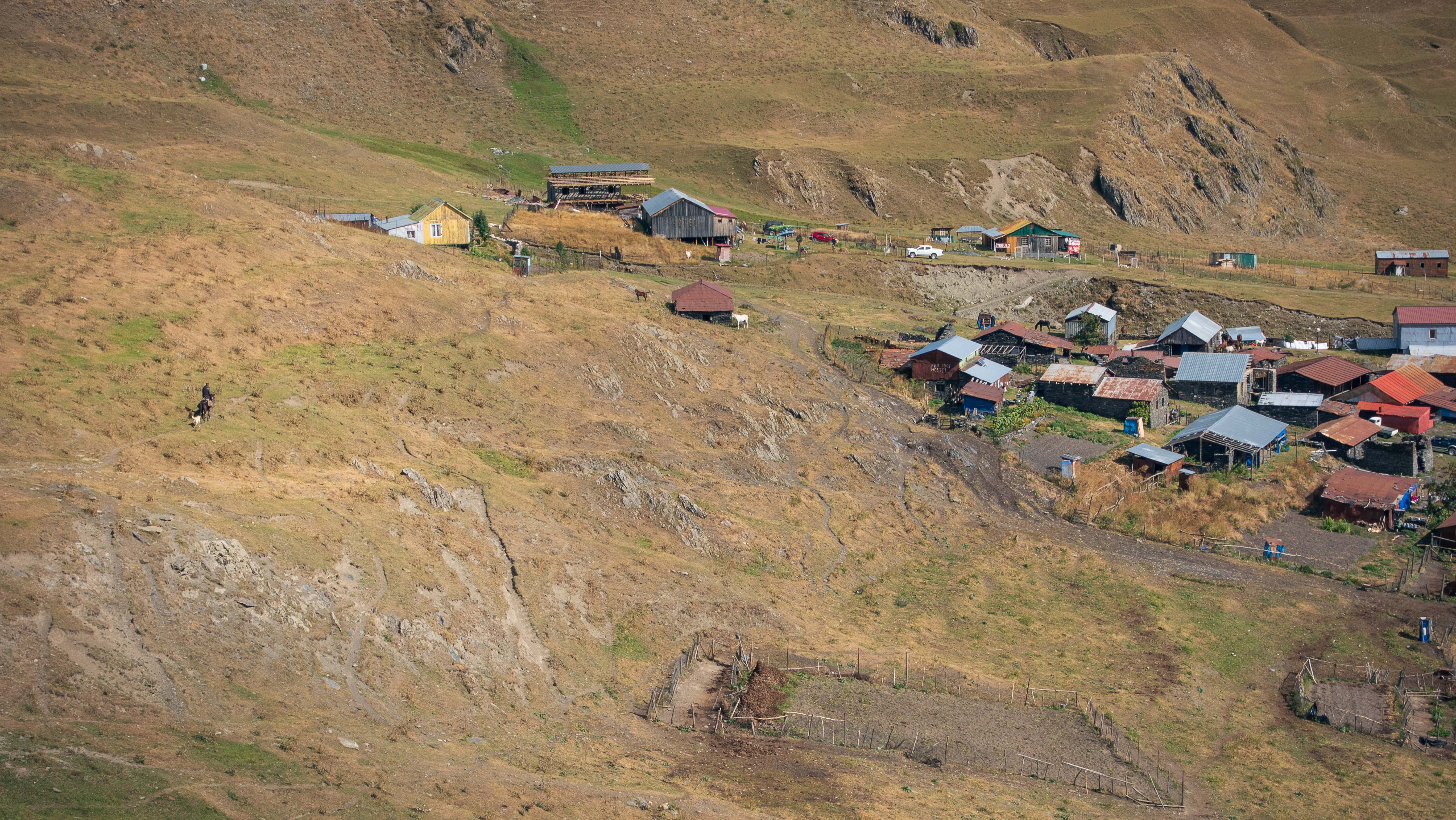
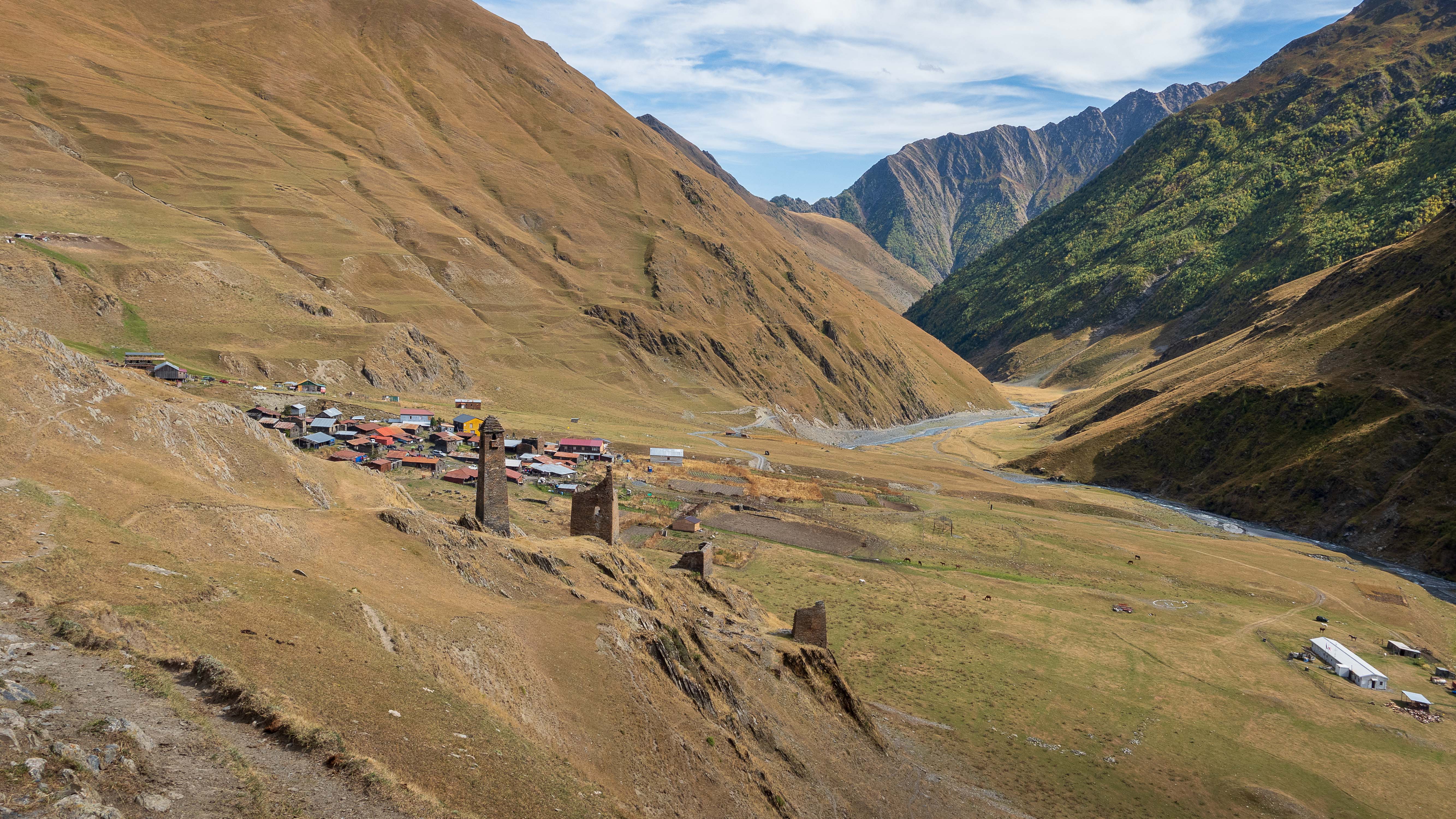
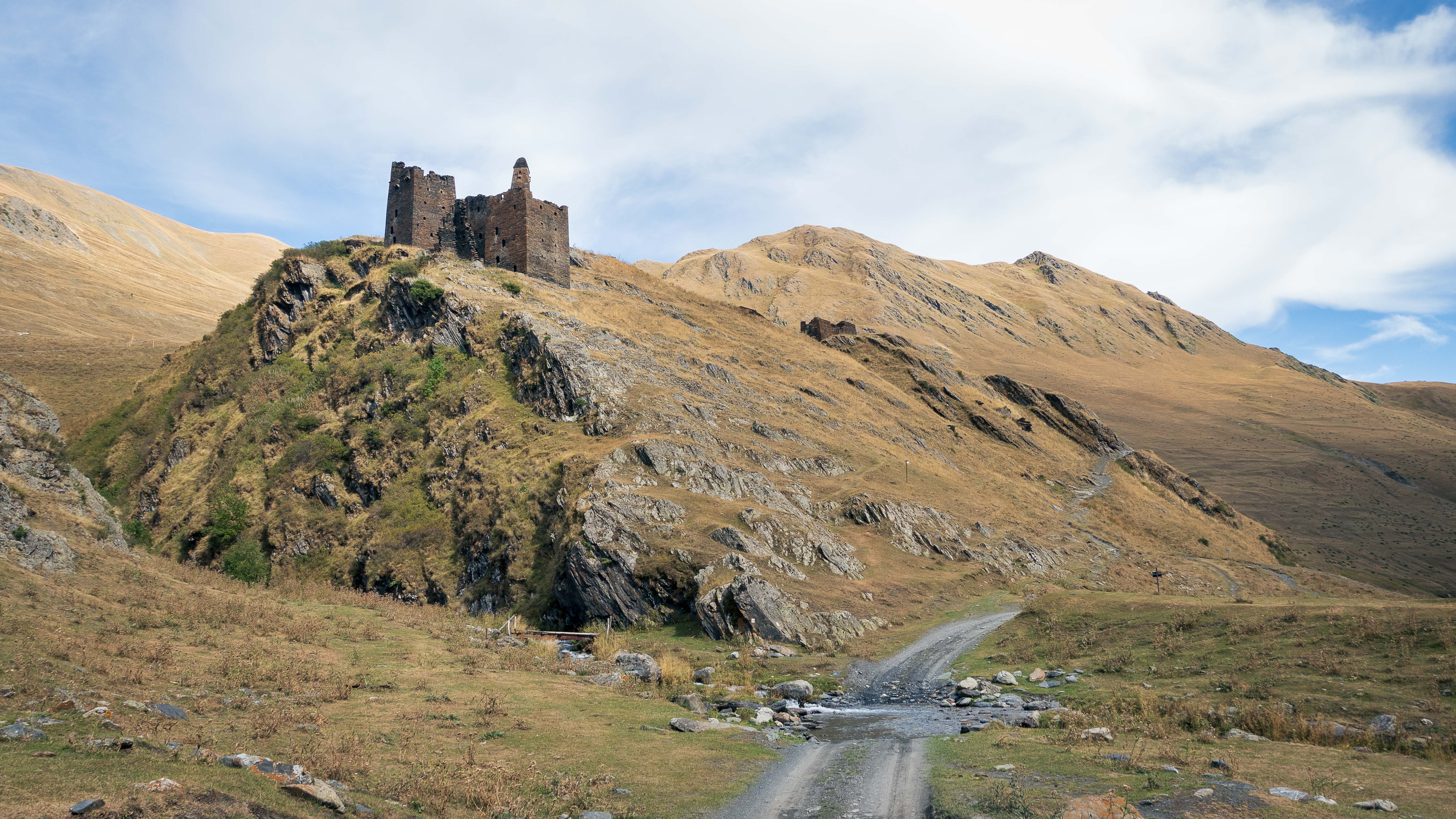
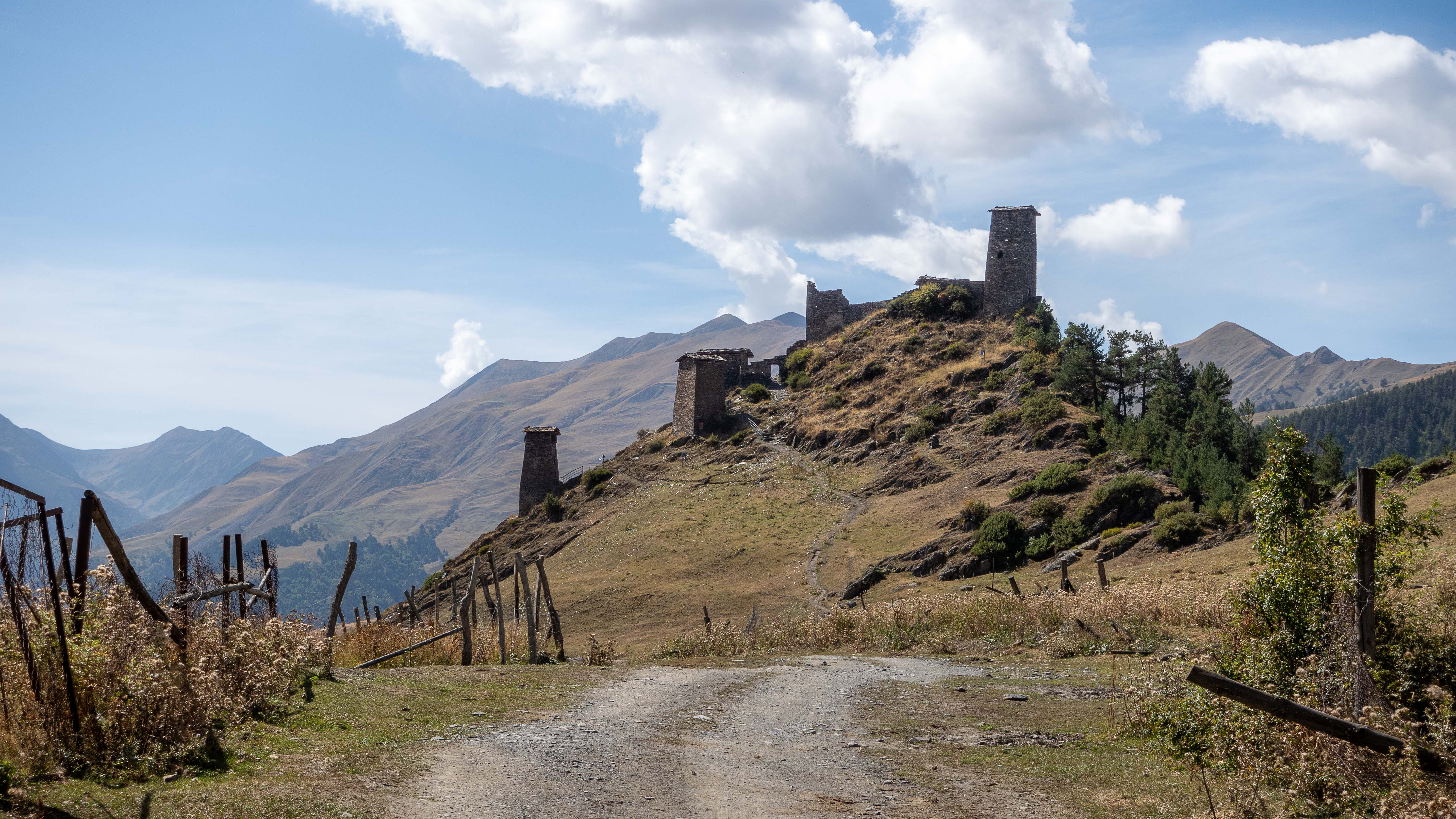
After the sun gets up, the day turns out to be pleasantly warm and trail at least half-rideable. I’m enjoying the fast progress compared to previous days, and the desolate Tusheti valley is really growing on me. There are majestic mountains all around, rivers flowing in valleys, ruins of ancient fortresses scattered here and there, and huge flocks of sheep wandering across the hills like slowly moving white blankets.
The best way to avoid meeting the infamous sheepdogs is obviously staying clear of the packs of sheep – with as wide a berth as possible. For me, this typically meant long detours off the trail when a flock of sheep appeared ahead.
Finally, in the afternoon, I find myself approaching a narrow ravine with a steep hill on one side and flowing river on the other – and a big flock of sheep in the middle. Right where I need to get through. I spot the big sheepdogs from afar, and they seem to be acutely aware of me as well. There is no way to get through the flock unnoticed.

Right when I’m about to gather my courage and enter the flock, two soldiers with rifles on their shoulders appear standing on the trail in front of me. They seem equally confused and surprised to meet me, but quickly recover their authority, by asking for my border zone permit. Lucky I actually did get one earlier.
Curious of my bike and my way of navigating in the mountains, the soldiers turn out to be really friendly, and after handling the necessary permit-check, we end up sitting down chatting in the sun.
After a bit of discussion, I hesitantly share my concern about to the flock of sheep and dogs on the trail ahead of us. Establishing this requires quite a bit of sign language, making sounds of barking, and pointing towards the flock. When the message finally lands, the soldiers keenly offer to escort me through if I want them to. Alongside the rifles, both men are equipped with huge wooden sticks, which I assume are helpful for both walking, as well as getting a bit of clearance with any dogs trying to get too intimate. I agree to the escort arrangement and we get moving.
Regardless of my armed military escort, I still feel quite anxious as we approach the sheep and admittedly formidable sheepdogs, eagerly doing their job trying to get us convinced it’s not our business to walk through their flock. Really happy I’m not doing this alone.
With one soldier ahead, me and my bike in between, and the other soldier following closely behind, we slowly move through the sheep with dogs barking and growling all around. The confident soldiers and their sticks do the job. Regardless of constant threatening and barking, the dogs let us pass through untouched.
Thanking the soldiers profusely, I mount my bike and continue ahead. First encounter with sheepdogs successfully cleared.
Back to civilisation (of sorts)
As I get closer to Girevi, there’s actually a bit of traffic on the trail – mostly horsemen quickly galloping past me with a wave and quick hello.
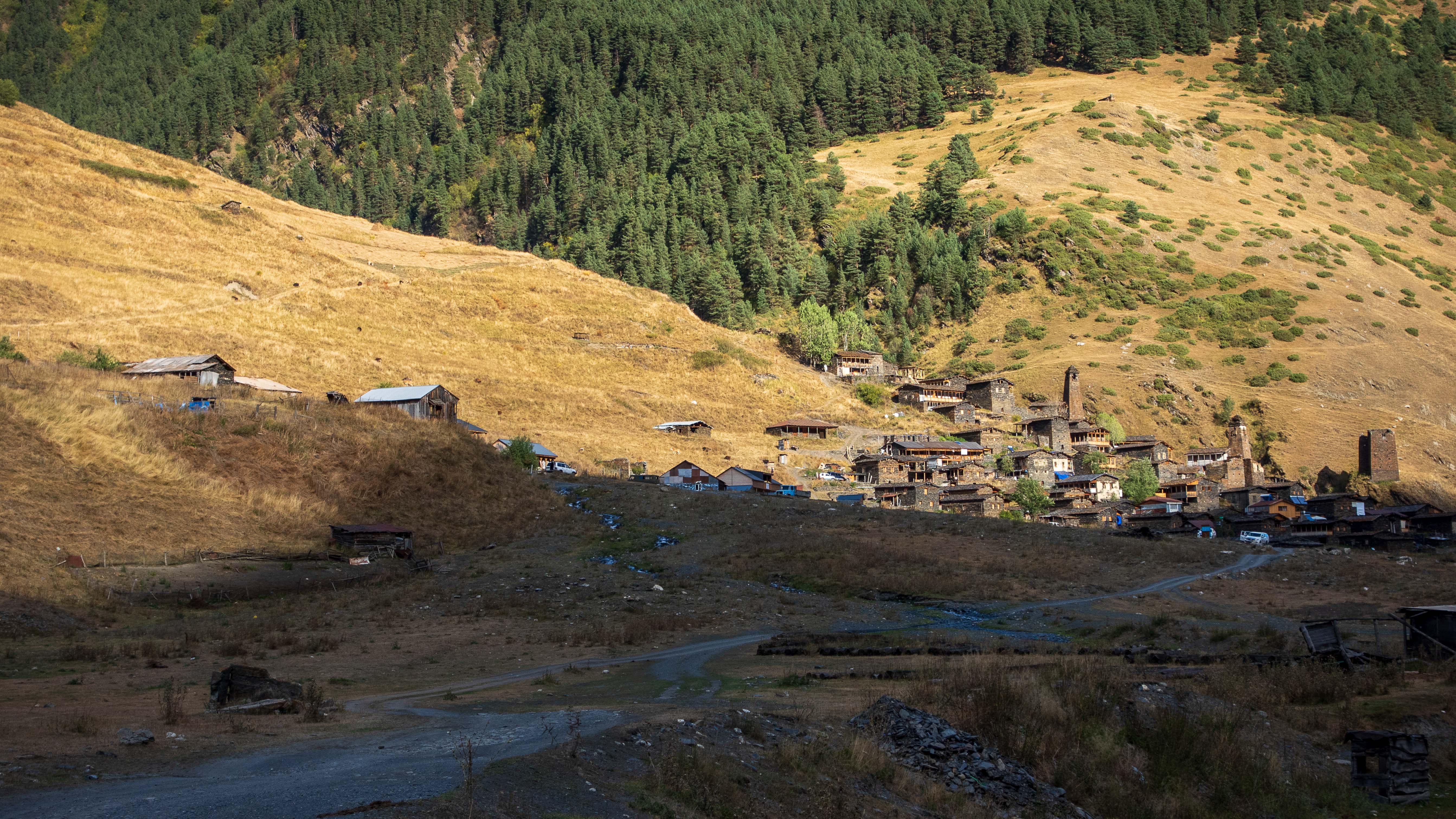
I reach the village around 3PM. With plenty of daylight left, I make a snap decision to just ride through and continue my way towards the bigger village of Dartlo 20k ahead. There’s a dirt road following a river all the way. Should be smooth riding.
The guide hiking with the Latvians had suggested me a guesthouse in Dartlo, but as I arrive, it turns out to be closed. Luckily, the only open guesthouse in the village is right next door and I sort myself a room, shower, dinner, breakfast, and a packed lunch for the next day – all for less than 30€.
When asking if the shower gets warm water, I’m shown to a small stove next to the sower room. “If you light it up, warm water it is! At least for a short while!” I try to scrub myself clean as quickly as possible. Not a small feat after days of hike-a-biking. Cows wandering the front yard keep staring at my naked butt through the open door.
After a huge dinner, I retreat to my balcony watching the village below quiet down as the darkness falls. There’s no electricity other than the occasional solar panels. Very few lights are on.

Best of Tusheti
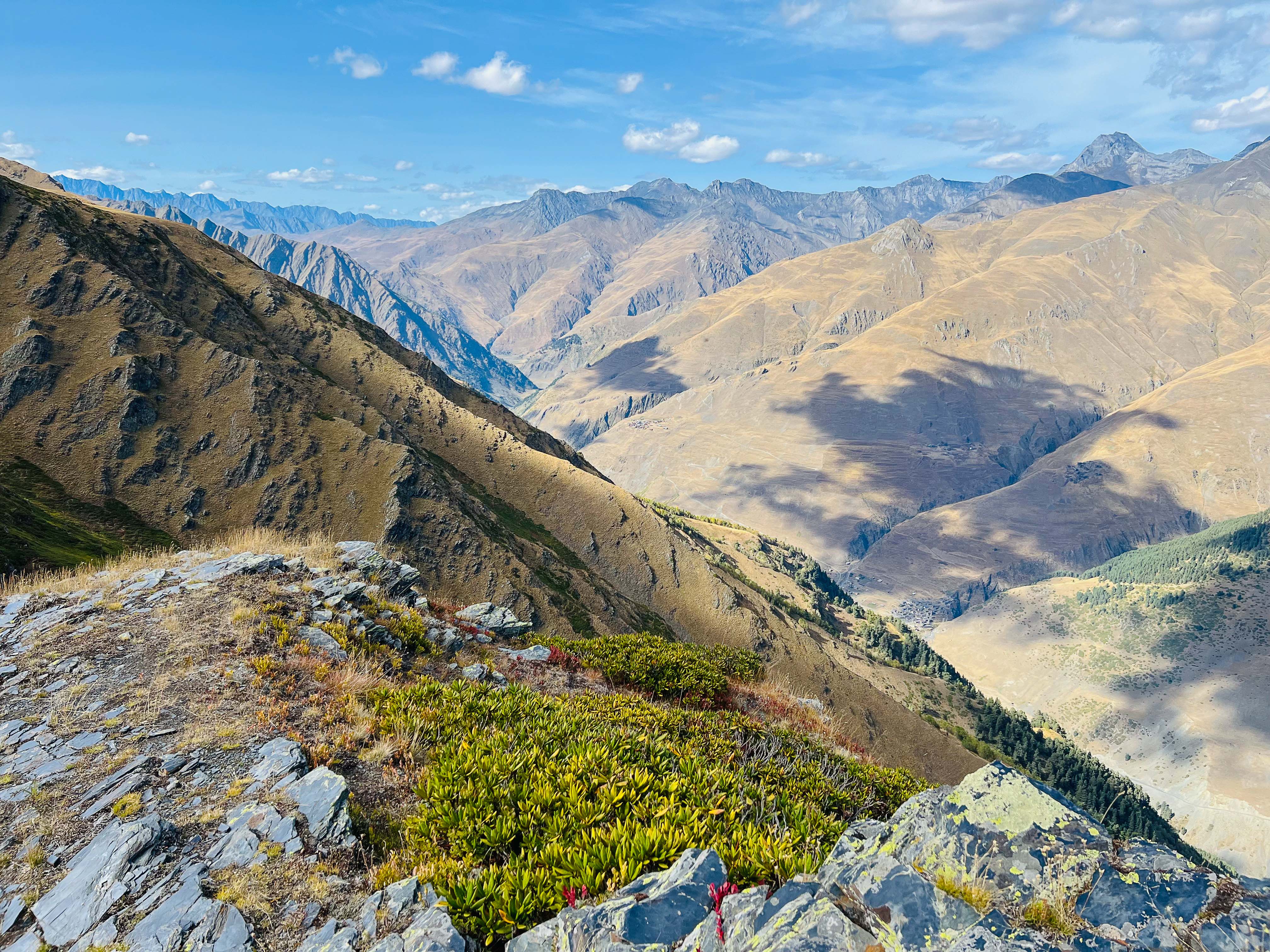
Following day, the trail takes me straight up the opposing mountainside to a long ridge high above Tusheti valley. Previous night’s excellent sleep in an actual bed for a change, huge Tushetian breakfast, and a bag of local “energy bars” (pastries with meat inside) got me up the climb with a newfound energy.
It’s a clear and sunny day with visibility all across Tusheti. From above 3000m altitude, I finally get to see the valley from above in all it’s glory! Surrounded by snow-capped peaks with glittering rivers in the valleys below. This is definitely the best Tusheti has to offer!
Once up the ridge, the trail is actually quite rideable but I struggle to keep my eyes on the trail instead of admiring the scenery. I take my time for shooting photos and sitting in the sun enjoying the plentiful “Tushetian energy bars”.


As the afternoon starts to shift towards evening, I realise I’m still high up the mountain and need to start picking up the pace get back down the other side during daylight.
It’s all downhill, but not really rideable. Bumpy fields with no trail. A scetchy singletrack next to a deep canyon. Don’t want any more accidents – my shoulder is still aching from the crash the other day. I’m taking several painkillers a day to keep it in check.
Once further down, I see a couple of abandoned looking buildings and consider camping inside one of them. As soon as I get closer, two big dogs shoot towards me, and I quickly abandon the idea. Guess someone is living there after all.
Finally, at dusk, the trail leads me to a river at the bottom of the valley. I see a dirt road on the other side. It’s already getting dark as I again strip to underwear. In the light of my head torch, I drag my bike across the river and up to the road on the other side.
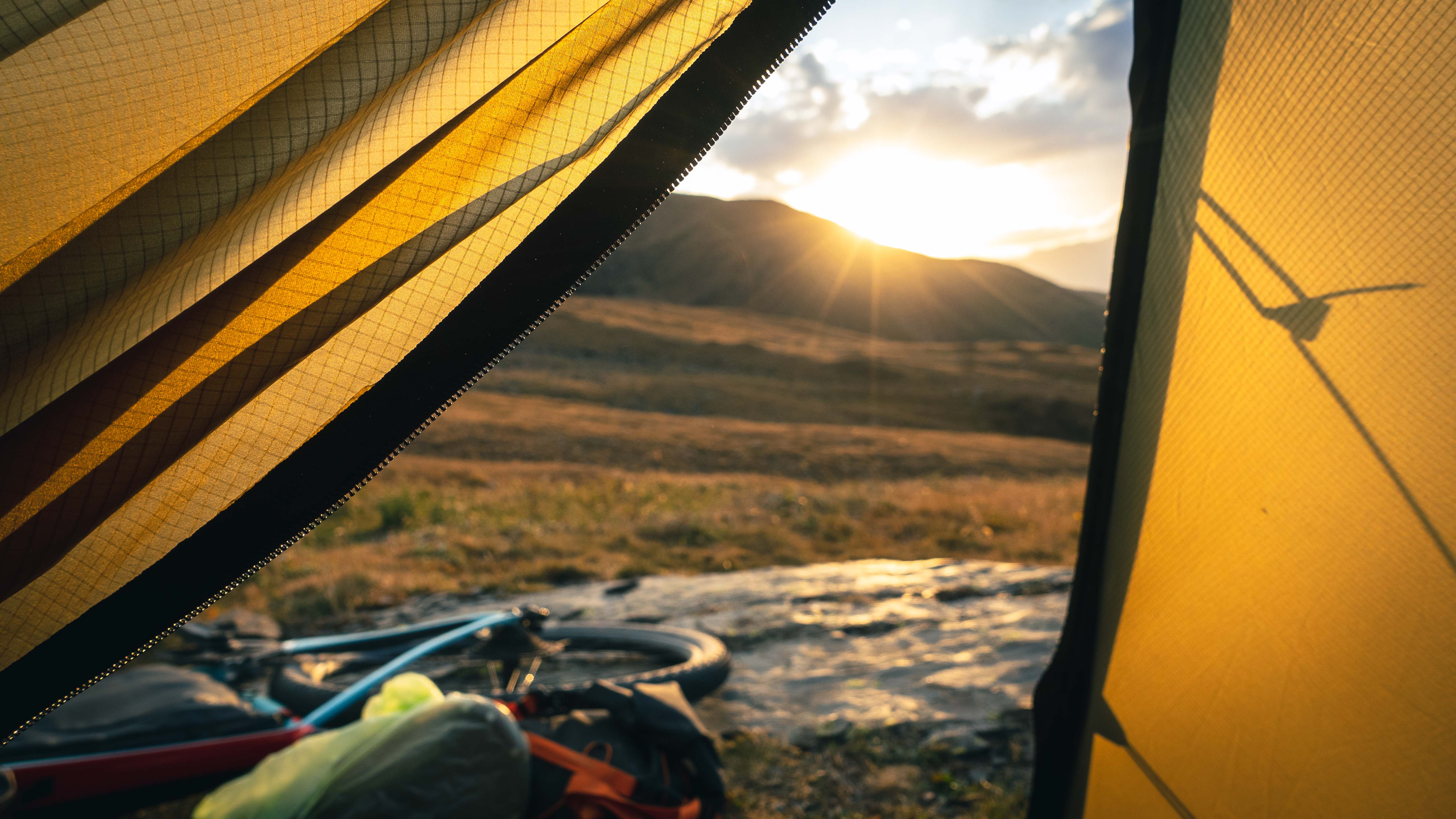
Need to find a campsite quickly – don’t want to be cycling in the dark. I spot a small patch of forest a bit higher up the mountain overlooking the river. That should work – just need enough tree cover to be hidden from the road.
Slightly worried about animals due to the strong scent of the “Tushetian energy bars”. In a weak attempt to contain it, I stash them in a waterproof bag before going to sleep. Not quite sure if my strategy works.
Only one car passes below at night. I dream of bears.
Temptations of Omalo
When trying to fit my swollen feet to wet biking shoes in the morning, I have a quiet laugh, realising the shoes have been constantly wet for days. Even on hot afternoons, they never really properly dry due to constant river crossings.
Omalo is the biggest village in Tusheti, and that’s where I’m headed today. I had already adjusted my expectations on Tushetian villages, but still, everything I knew about Omalo gave the impression, it was reasonable to expect a solid lunch there. Maybe even a cold beer if I’m lucky.
Idea of beer got me flying through the couple of early morning climbs, and I arrived to Omalo by lunchtime.
With steaming hot soup, fresh bread, and an actual cold beer in front of me, I sit on the terrace of the biggest guesthouse in town. Friendly owner does her best trying to make me stay overnight. Outdoor beds on upstairs balcony do look really inviting. I toy with the idea of sitting up there on a starry night with a beer in my hand. Really tempting.
Dark clouds are gathering in the horizon. If I leave, I may get hit by a storm again. Wasn’t fun the last time, eh? I need to summon all my willpower to actually pull myself off the chair and get back on the bike.
As I’m cycling out of Omalo, a car full of drunken men pulls alongside me. It’s Saturday afternoon, and the gang is already solidly drunk. Including the driver. I decline a number of offers for Chacha. On each offer, the guys take swigs for themselves. When they learn I’m from Finland, they immediately ask if I know Lapin Kulta brewery. True professionals!
Shouts of Kippis (cheers in Finnish) echo in the mountains as I cycle on, leaving them for a pee before continuing their drunken drive.
It’s a long uphill to Albano pass and I know I can’t make it during daylight. Full of energy after properly fuelling up in Omalo, I make a plan to cycle until dark, camp along the road, and continue up to the pass the next morning.
I’m on the only road connecting Tusheti to rest of the world, but the traffic is scarce. Maybe a car an hour in the afternoon. At dusk, the traffic dies down completely.

I meet shepherds with huge packs of sheep on the road, apparently heading out of the valley through the pass, like myself. They kindly help me get through the sheep-induced traffic jams using their sticks quite liberally to get the animals moving. One elderly shepherd asks me to stop for a chat, but with lack of common language it quickly boils down to smiling and him offering me candy from his pocket. I hand him one of my energy bars in return.
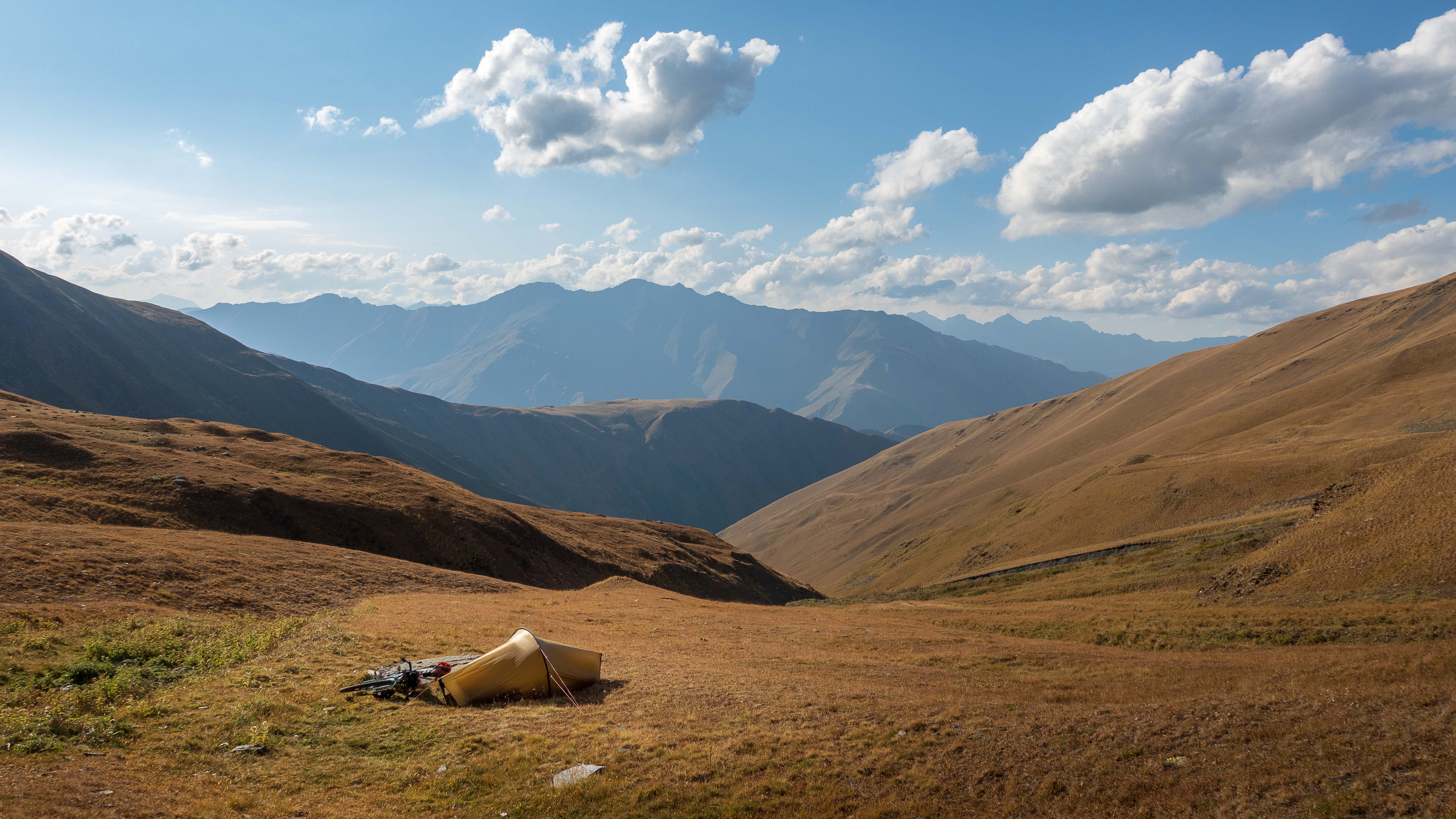
Sun has already set behind the mountains, but it’s difficult to find suitable places to camp. The road is carved on a rocky mountainside with no room for a tent. Finally, I spot a ledge above the road, to which I believe I might be able to climb with my bike and gear. Not optimal, but at least I would be out of sight.
Getting off the bike, I start pushing up a steep hill until the road is no longer directly in sight. I hear a car pass right below, but can’t see it. The lights pass the mountainside above me. Think I should be well enough hidden for a peaceful night sleep.
As soon as my tent is up, I hear the shepherds with their animals approaching on the road. It’s already getting dark, and I make sure not to use my head torch to reveal my location. I sit on the ledge quietly as the sheep and chatting men pass right below me. Until they stop.
Judging from the sound of it, they’re planning to camp for the night right below me. More people with a couple of horses appear and join them. I’m a tiny bit concerned of the dogs that might spot me up here and pull the rest of the gang to investigate. So far all is good.
I carefully push my head over the ledge and peer down. The shepherds have set up a small fire and seem to be planning to stay. Keeping my lights off, I sort myself for the night and fall asleep listening to the animals and people below.
In the middle of the night I wake up to gunshots from right below. Not sure what’s happening. It’s completely dark. Trusting I’m out of sight and hoping they’re just shooting a wounded animal, I continue sleeping.
When I wake up in the morning, everyone is gone.
Albano Pass
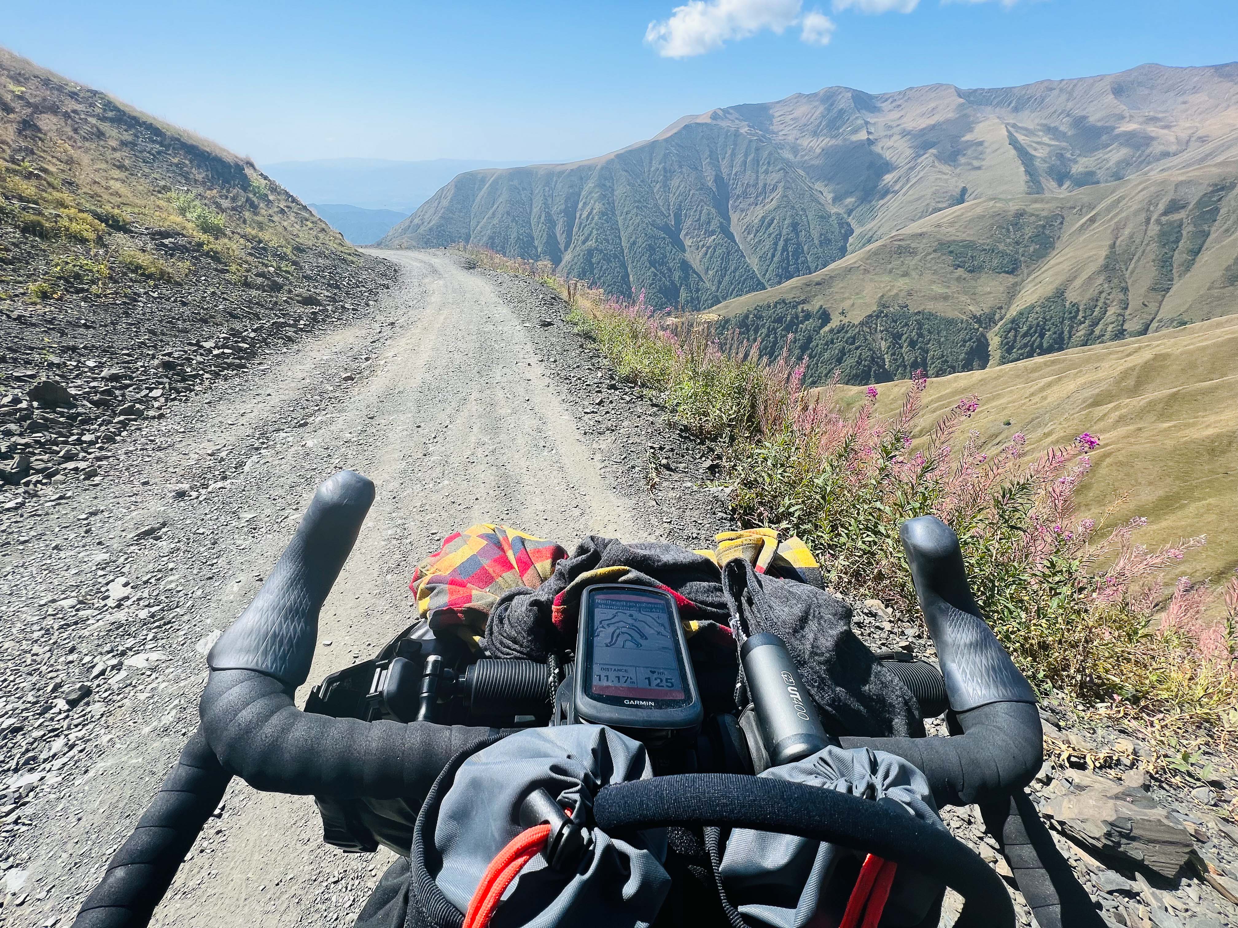
The only road to Tusheti leads through Albano Pass. At close to 2900m altitude, the road is open only part of the year, and even in the summertime, it’s deemed as one of the most dangerous roads in the world.
I start climbing as soon as I wake up. Through the morning, only three cars pass me. Every single one stops to ask if I’m OK and if I need something. The short discussions provide a welcome distraction from the monotonous climb.
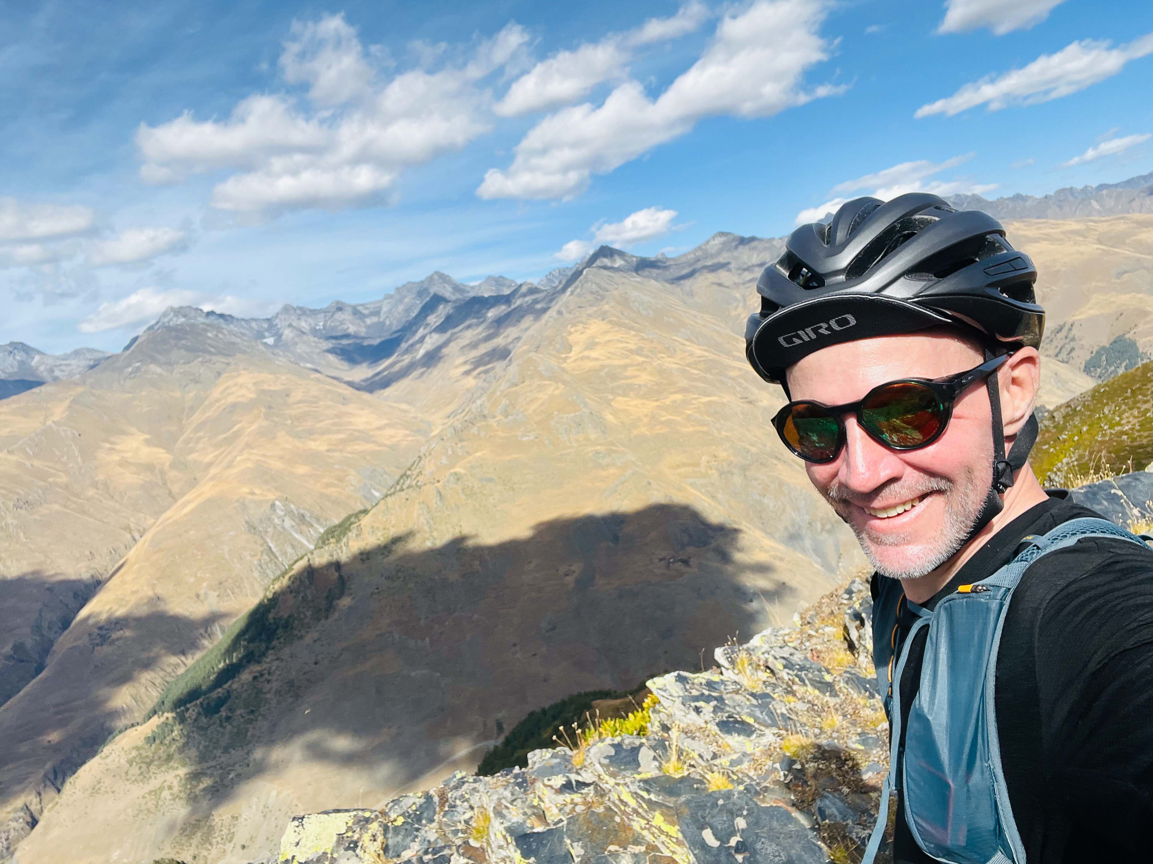
By noon, I’m standing at the top.

Brief stop for photos and a bit of energy before the long downhill to civilisation. It’s the longest, bumpiest, and funniest downhill I’ve ever experienced! Easy to see why the road can be dangerous – steep drops, landslides, rocks falling from above. Countless graves where cars have crashed down.
After hours of coasting downhill, trusting my breaks to make it all the way, I finally land on the first asphalt road in a week. Riding downhill on asphalt feels like cheating after the long push through Tusheti!

As soon as I spot the first proper shop, I ditch my bike outside and charge in. With a stash of ice cream, coke, chips, and candy, I sit in the shade munching through everything in random order.
Smelling like a cyclist and covered in dust, I finally coast down to Alaverdi Monastery at sunset to meet my driver. He’s about to take me and my bike to the western side of Georgia for the next phase of my Caucasus Crossing – The Lesser Caucasus.
But that’s a whole another story!

Incredible story! I don’t know how you do it how you brave the elements how you brave the unknown but I’m constantly amazed at your successes! You should definitely submit the stuff to Outside magazine some of the best writing I have read regarding these kinds of trips. I think they’d be fascinated. Stay safe on the trail and I look forward to your next blog post! Cooke
LikeLike
Wow thanks Cooke, humbled by the feedback and encouragement! I try to learn this writing thing over time, but still a lot of practicing to do. Luckily, I find both adventuring and writing equally fun – with a bit of video shooting and editing thrown in the mix 🙂 Stay safe!
LikeLike
you should submit some of your stuff!
LikeLike
This is such an incredible adventure, Teemu. Thank you for taking the time to share it in such detail. I felt like I was with you on the trip. I was breathing a sigh of relief when you got your border permits. Though I definitely know I wouldn’t be able to keep up…lol.
Lots of things resonated with me. The kindness of all the strangers. Like the man on the horse who carried your bike across the river. Drivers stopping to see if you were okay. And even one giving you some ice cream.
There was the isolation of the region and the steep passes where the mountains block GPS signals. And being so vulnerable with the lightning storm on such an exposed mountain. Such a scary crash on the other side of Atsunta Pass.
I not very around dogs. Good that you were able to get escorted through the flock of sheep with those dogs around. Much respect for your wild or stealth camping skills, Teemu. That’s an adventure in itself to find a location that avoids detection.
Absolutely amazing adventure travel recap! 🚵♂️
LikeLiked by 1 person
Thank you Carl! 🙏
LikeLiked by 1 person
You are very welcome, Teemu.
LikeLike
Do you have a GPX of your trip? I would like to do a very similar loop !
LikeLike
Hi there, how was it for food and water?
LikeLike